Saturday, January 10, 2015

PCT Offline Maps

Before hiking the PCT, I got hold of a very nice and comfortable file containing all the maps along the PCT. I got it from a friend, and I don't know how he got it, but it was very helpful indeed, especially when I used it along with BackCountry Navigator and the GPX files from Halfmile's site.
The past week, I've been fiddling around with creating a similar file myself, so I can freely post it over here, and distribute it to anyone who might want it. This post might get a bit too technical, so if you are here is just for the file,

It's in here (637Mb)

(Download on your home computer, or via Wi-Fi) Here's how to use the file as a map source in BackCountry Navigator:
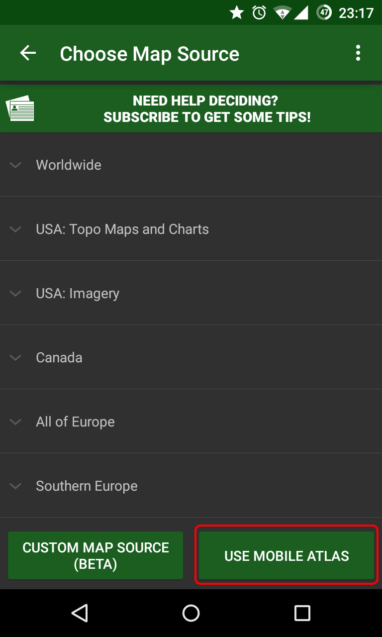
  1. Copy it into your Android phone, under the bcnav\atlases folder (not sure exactly on how to do it on iPhone, but I assume it can be done).
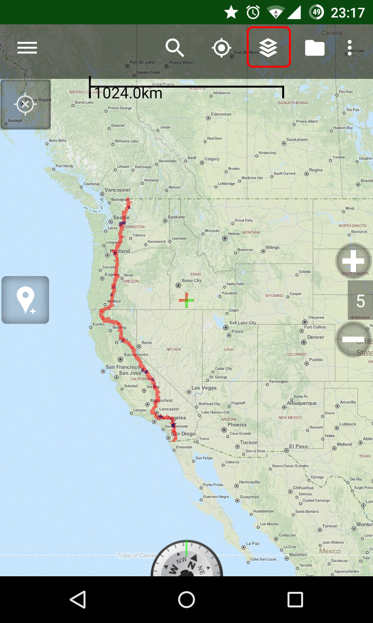
  2. Inside BackCountry Navigator, tap on the "Layers" icon at the top
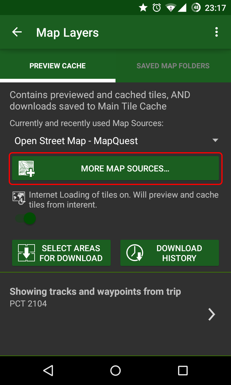
  3. Tap on "More Map Sources..."
  4. Tap on "Use Mobile Atlas" and select the file.
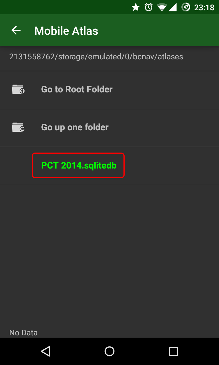
You will now have good quality topographical maps all along the trail, from Mexico to Canada. All you have to do now, is import the GPX files from Halfmile's site, and see the trail, side trails and waypoints, directly on the map.

And now, to the technical bits -
At first, I looked around the internet for the source of the file I originally had. I quickly found OpenStreetMap and OpenCycleMap as available map tile resources (though they do not freely allow bulk download of tiles). The OpenCycleMap project does show elevation lines, and would be appropriate for navigation while hiking.
I needed to go over the whole trail (a collection of lat/long coordinates), and for each such coordinate, download the appropriate map tiles, on different zoom levels (zoom level 0 is the entire world. zoom level 15 is a very well detailed map of about 4.7 meters per pixel, or 5.2 yards per pixel). Since the trail is continuous, many coordinates will appear on the same tile, so I'll only have to download tiles I haven't downloaded before.
Searching some more on the internet, I found the excellent free application Mobile Atlas Creator (MOBAC), which is doing exactly what I was looking for - it can take in data from GPX files (but not Google Earth KML/KMZ), select a map source, and pick all the needed tiles to download from the source. Then, it can create an Atlas, for different navigation applications. It already has a setting for BackCountry Navigator sqlite format, which was just what I was looking for. But if anybody here needs the offline file for a different mapping application, I will gladly help with creating it as well.
I had one major problem with using MOBAC - it did not contain the tile server source I was looking for.
Searching around some more, I ran into CalTopo, another nice site which allows different tiling servers to be displayed inside the browser. I finally found the source I was looking for, while looking around in their different options. It was ArcGIS USA Topo Maps. Success!
That was the bit where I started writing my own code, and putting up a simple application that reads a KML/KMZ file, calculates all the tiles it needs to download, and downloads it all from a selected map source. I had fun writing this app, and I think I will still improve upon it. But two days ago I realized I can just add this map source to use in MOBAC, and it deal with the entire downloading and packaging the result for me.
So yesterday and today I did just that. I let MOBAC do the heavy lifting. Another annoying thing in MOBAC is that it only lets you select tiles along a single track every time, so I downloaded the code, and changed it a bit to allow adding multiple tracks at the same time. It made making the Atlas much easier.
I kept getting a huge Atlas as a result, though. My original file was ~500Mb, and I kept getting files that were more around 4000Mb. That's quite a big difference. I kept fighting with it today, until I finally realized that MOBAC was downloading the tiles as JPG files from the tile server, and then converts them into PNG files, which increases their size (And not their quality). After realizing that, I've finally been able to create this file here, for the enjoyment of every future PCT hiker!
I will make similar files for other trails as well (AT, CDT, JMT, for start. And also the INT and some trails in Europe, but with different map sources). I will also gladly help anyone needing those files to be in different output format, for other mobile navigation apps. Don't hesitate to ask!
Saturday, January 3, 2015

Useful (and not so useful) Android apps for the trail

A long time before I started my hike, I decided I'll carry my Nexus 4 phone with me on the trail. I knew it will come in handy both as a phone, to keep in touch with my family, and as a way to access the internet.
While my specific phone is not the most recommended model for the task (It's battery is really not up for the challenge), I did enjoy it for many different uses and scenarios. Here is a list of the apps I used on the trail, along with a few that were disappointing or just weren't used that much.

Amazon Kindle / NOOK

I personally did not read any eBooks on the trail, but for anybody who thinks about carrying a Kindle or NOOK device with him, this is a better option, in my opinion. The screen is smaller, and the battery life is not as good, but it does the trick.

Audible / NOOK Audiobooks

I really got into listening to audio books on the trail. And Audible offer a free first month, in which you can just get 1 free book. Good deal.
Usually before long climbs, I'd put on the book I'm currently listening to. I must admit - the 2nd book I took was total crap. But it still helped me during long days.
Just make sure you do cancel your account after downloading your book - they are very persistent with their "are you sure?" dialogs, and I managed to miss it and ended up paying for one extra month. The base price is ~$15, but I got an offer of ~$7.5 for several month, in my (finally successful) cancellation process. Also a good deal.
I never tried NOOK Audiobooks, but I would guess it's quite similar to Audible.

BackCountry Navigator TOPO GPS

Now we are in the big league - this is one of the most useful apps I had. While the link directs to the trial version (I think it's good for a week), the full version does cost a bit (I think it's $15. Is it $15?). I had file that contained full topo maps of the entire PCT corridor, for offline use (I'll post it in my next post). That, along with Halfmile's GPX file was all I actually needed to hike the trail and stay on it. After getting a GPS fix, I could immediately see where I was in relation to the trail. It was really helpful in the High Sierra passes, where Idan led Yair and me safely down snow covered trails. There are other, similar apps, such as Orux Maps, which might also do the trick. Highly recommended, either way.

Blogaway for Android (Blogger)

I used this app for most of the way, just to write my blog posts from the trail. After starting with the official Blogger app (next in line), I found this app to be much much better. It still had plenty of bugs and errors.
I'd usually write my blog posts in the evening, with no cell service around. At first, I assumed the app will remember the time and location of where I created the drafts, and keep this data for when it actually uploaded it to my blog, when I got into town. I found out it was not the case, and at first I had many mismatched blog entries, with wrong dates and locations. I discovered I should "schedule" each draft I'm writing, to the current date of writing it (effectively scheduling it to the past), so that the upload later would post it with the correct date.
Many times, while in town, on cell service, or some local Wi-Fi, I had to kept trying again and again to upload my posts. It would fail uploading a bit too much for my taste. I also had many occurrences of missing uploaded photos. But it was still better than the official app -

Blogger

A terrible, terrible app. Don't go near it. This app is not maintained and is buggy as hell. No solution to writing posts while being offline, uploading posts sometimes result in broken images, trying to edit current posts causes the app to crash. Completely useless. Stay away.

DropBox

I used DropBox to backup all of my photos from along the trail. I had it set to automatically sync every photo on my phone up to my Pictures folder, and occasionally had my wife back home copy it all outside, to free up some space. The photos I took along the trail are one of the few things I always worried about loosing (and I lost about a week in the Sierras.. damnit), and being able to backup them on the go was very nice.
I also used DropBox to get an audio book from my wide (The Brothers Karamazov, in case you were wondering). That was also very simple and nice.

Facebook

I guess there's no need to introduce Facebook. It was just a good way to keep up to date with recent changes and information on the trail, as well as a nice way to keep in touch with friends and family. It's useful, occasionaly.

Google+

While it hadn't really caught on as a social network, I still used it to backup my photos as well, as a backup to the DropBox one. It's just as simple as DropBox, and it's just one more place where my photos were kept safe.

Google Camera

A nice camera app from Google. It does the trick, same as most other stock or non-stock camera apps for Android. I really liked the Photosphere option, and I took such spheres in the high passes of the Sierras, but that needs some matching hardware, and I think it won't be available on every Android phone. Anyway - I used a separate pocket camera for most of my photos, and rarely resorted to using my phone. I still think this camera app is nice, though.

Google Drive

Google Drive, along with its accompanying apps of Docs and ;Sheets, was helpful to keep the various pdf and documents on my phone, even with no data reception at all. In Southern California, I kept the Water Report available for offline view on my device, and only had to occasionally let it automatically update itself when in towns. I also had my PCT Planning spreadsheet handy, even though I was not following my plans to the letter. It was handy many times.

Google Play Music

As a music app, this one is nothing special. It has all the normal bells and whistles, like searching for a specific artist or album, and shuffling the results.
The basic, and free, service it offers, is the ability to easily upload all your music library back home (up to 20,000 songs) to the Google cloud, and then listen to it using the app, from wherever you are. A data connection is necessary when listening to new songs, but it automatically keeps songs on your device, for offline listening later, and you can also select albums and songs to be actively downloaded to your phone.
I also really like the paid service, currently called Google Play Music All Access, but it is actually the same service as the newer YouTube Music Key, which allows you to add any song or album in the Google Catalog into your album, to listen to while online, and to download for offline use. So basically - limitless music access. Awesome.
Every few weeks, when I got into town, I cleared the music cache on my phone, and started selecting a new and eclectic music selection for my next section. Towards the end, I selected many albums I've never listened to before, by artists I heard about, but never actually got to know. It was very nice, having the option to easily get so much content like this.

Google Voice

Using Google Voice, as someone coming from Israel, it was much easier for me to switch between T-Mobile and AT&T, while keeping the same Google Voice number so that people could reach me. It took me some time to figure out how to do that, but it is a nice trick.
I also used it extensively to call to Israel, while paying for a non-international plan on StraightTalk. With the introduction of the Hangouts Dialer, every Wi-Fi access point becomes a way to call the outside world (you'd be surprised how many places have Wi-Fi but no decent AT&T cell service), and currently, Voice calls to many US phones is also free. So it's worth it.

GPS Status & Toolbox

This app is a nice one to have when trying to get a GPS fix, as it tells you how many sattelites are currently visible to your phone, and you can get mad and annoyed at your phone, staring at the screen, and waiting for it to finally get a fix. It is also very useful in that it can automatically download AGPS data (Assisted GPS data), when you have cell service and a data connection, that greatly speeds up getting a fix. It is recommended downloading this data whenever you can, so that in those far out places you try to get a fix you will have the most recently available data.

Halfmile's PCT

Another must have app. Or at least, one at the top 3 I used on the trail. While using BCNav and my offline maps is all one needs to keep on trail, I rarely actually had to use it (and eat up my battery on getting a GPS fix) - I just used Halfmile's app instead. I was worried the lack of a map view in the app would be annoying, but I can now say it contains everything that a hiker needs. Knowing where you are, and how far it is to any other location on the trail. Simple and elegant. I also really liked the cumulative elevation gain and loss info between locations (even though they are not always accurate), and have it used extensively to plan ahead my next section or sections. An amazing app, and I'm sure the 2015 edition will be even better and more accurate, after Halfmile himself logged the entire PCT this year. Thanks again to Halfmile and White Jeep for their hard work on making this app available.

Hangouts & Hangouts Dialer

I mostly just used Hangouts to keep in touch with my family back home. I like it better than WhatsApp, but I guess they both work similarly. It's just a simple and easy way to keep up with people. The Dialer add on though, is quite awesome. It only came out when I finished the trail, but it was very handy on the bus ride from Manning Park to Vancouver - I had no data plan for Canada, but the bus had free Wi-Fi, so I was able to use the Dialer and my Google Voice account to call Israeli cell phones easily. It worked like a charm. If it were available for me all though the trail, I might have skipped getting a phone plan entirely, and only relied on Wi-Fi access to call home. Maybe not. But it's a very nice feature.

Panasonic Image App

Not very recommended, unless you have a matching Panasonic camera with Wi-Fi access. But once I got my new camera and started using it, it was much easier for me to transfer the photos from my camera to my phone, and from there, using DropBox and Google+, backed up in the cloud.
The app itself is not exceptionally good, only allowing up to 10 photos to be transferred between the camera and the phone in each batch. It's quite a pain, when you've got 150+ photos you need to send over. But at least I had a way of getting those photos.

PCTHYOH

A simple app that allows you to cache many different PCT resources, including Halfmile's maps, the Water Report, and other such resources. I never actually used it, but I met some hikers who really liked it.

Guthook's PCT Guide / Guthook's Tour of the PCT

While being "faithful" to the Halfmile's app, many other hikers I've met used Guthook's guides on the trail. They cost ~$6 per section (5 sections for the entire PCT), but they seem to be worth it. The data, at least during 2014, was probably a bit more accurate, with more water sources and camp sites available on Guthook's. I would imagine the 2015 versions will be more similar in that regard.
The Tour of the PCT app is free, and is meant to be used for planning the PCT in advance. For a full data set inside the app though, it does require an in app purchase of several dollars.

Better Diary

I only discovered this app recently, and have never actually used it, so this is just a suggestion.
Before the trail, I mostly wanted a blogging platform/app for my own uses, so I will be able to remember my time on the trail. The benefit of letting the world know of my adventures was a nice bonus, but not the main thing I was looking for. Recently, I found this nice diary app, which seems to be doing just what I was looking for - It allows you to easily write daily posts, automatically adding the location (and current weather - I guess this won't work as well with no data service). You can also share your diary with other people, making it into a simple blogging platform, at least for close friends and family.
I don't know how well it all works while being offline, but I would definitely recommend giving it a try.

Sunday, December 28, 2014

Confessions of a Thru-Hiker

I started my hike in an attempt to hike the entire PCT. Being the anal person that I am, I meant to do it all, without skipping a single step. Yes, I am one of those stupid purists who gets a ride into town from one side of the highway, then gets back to that same side on the next day, to hike on from the exact same spot.
However, after a while I gave up. I wasn't enjoying the trail that much, and I had thoughts about quitting. When the opportunity arrived, I decided I don't care that much for the trail anymore, and I should just do whatever I want to, instead of forcing myself into following stupid rules, for no logical reason at all. So I started skipping.
I wasn't skipping whole giant sections, hitch hiking up and down the trail. Not that there's anything wrong about it. But I occasionally let myself off easily. I admit.
After the Sierras, when I decided (again) that I want to keep on, and hike the entire trail, I decided I'd try to go "pure" again. I knew it doesn't matter. It never did, actually. All that matters is whatever I felt matters. Being pure now won't change me being not-pure before, nor should it. I just decided again I wanted to try it.
I started making lists in my head, about all the different miles I had skipped. I figured maybe somehow I'll do them again someday. I don't expect I will, now. But I wanted to write down all the trail miles I haven't walked, with the reasons/excuses I gave myself every time. Some are better than others.
I got up all the way to the closure
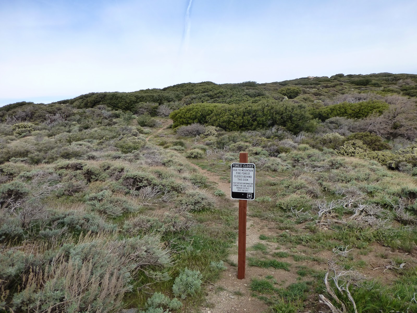
162.64-178.00 (Cedar Spring Trail to Tahquitz Peak Trail) - The famous ;Mountain Fire Closure. The trail is closed between those two locations, though most hikers get off the trail at Highway 74 (mile 151.86), and either hitch into Idyllwild, or road walk all the way there on the highway. From there most climb up to San Jacinto on the Devils Slide Trail on mile 179.40. I hiked on north from Highway 74 with the intention of getting down the side south-western side of the mountain at the Cedar Springs Trail junction, and then road walk on the highway up to Idyllwild, and climb through Tahquitz Peak back to the PCT. My plans got foiled when I twisted my ankle right before I got to the highway, and I hitched into town, rested there for two days, rested two more days at the ADZPCTKO, and then got a ride back to Idyllwild and limped up to Tahquitz Peak. I entertained a thought of getting back to the road walk, on my way back from the Kick Off, but at the end I decided I would skip that boring and dangerous section.
252.06-266.04 (Onyx Summit to Highway 18) - I took a zero day at Ziggy and The Bear, feeling really light headed and not up to hiking, and Idan went on without me. We were supposed to meet again in Big Bear, in 4 days. After hiking two days alone, and feeling really depressed and done with the trail, I suddenly came upon Onyx Summit. I was surprised to see a road leading to Big Bear, and even though I planned on hiking ~6 more miles, and then reaching town on the next day, I changed my plans and headed into town from there. I had cell service, and talking to Idan I realized he was already zeroing in town, and would leave tomorrow. So if I'd take another day, I'll have to keep on hiking alone. I spent a boring and lonely evening in Big Bear Lake, and met up with Idan and headed out from the next road crossing on the next morning.
386.25-398.19 (Islip Saddle to Highway 2, 6th crossing) - This one was around the Endangered Species Closure. The official trail is closed from mile 390.30 (Eagles Roost) to mile 394.30 (Burkhart Trail), but the official detour starts here, at 386.32, and goes around for 20.22 miles (instead of 8 miles on the trail), all the way to Burkhart Trail. There is also an old alternate, that loops right around the actual closer, and is only 5.44 miles.
When we got to the road crossing right before the official detour, we were planning on hitching back into Wrightwood (After spending the previous night there), and have already called a local trail angel that will let us crash at his place for the night. Our plans weren't met with success, as we were trying to hitch on that deserted road for ever, and nobody stopped for us. Finally, as the sun went down, we made camp at the rest area over there, and crashed.
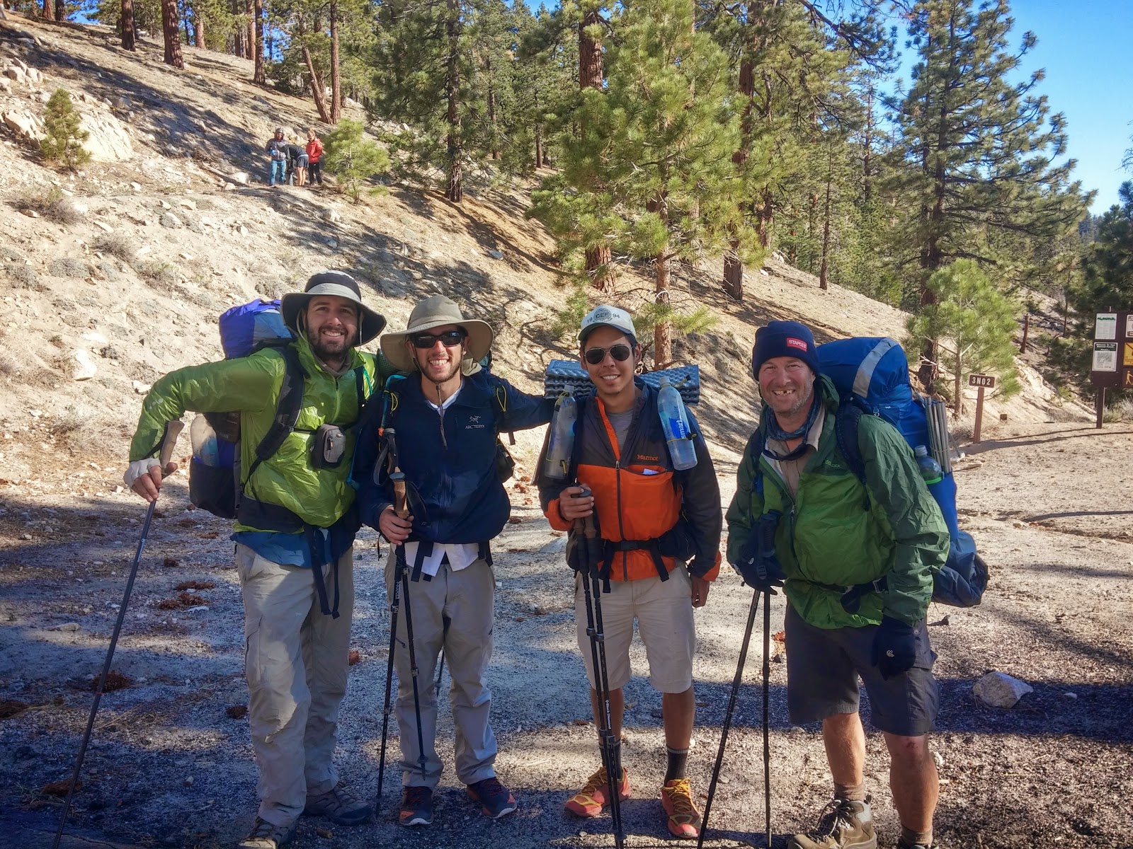
4 happy hikers, after cheating the trail a bit
The next morning, we wanted to at least get a ride to the end of the closure (thus skipping both the official, 1 day extra, alternate, and the old alternate). We didn't have any hitching luck in the morning as well, until we saw Kyle and Snail Trainer coming down to the road. They spent the previous night at Little Jimmy Campground, and met a weekend hiker named Barbara, who agreed on taking them around the closure. We joined in on the ride happily. Very quickly we got convinced to hitching all the way to the next road crossing at 398.19, instead of getting of at Buckhorn Exit, and hiking an additional 2.16 miles just to get back on the trail. As a consequence, when we finally crossed the 400 miles marker, I didn't feel like it was much of an accomplishment.
454.50-456.65 (Exit for Hiker Heaven to Unpaved Road) - After spending a nice zero day at Hiker Heaven, we took our time on heading out of there. I think we left a bit later in the morning, but still before noon. Donna arranged for a ride to the trail, just to save us the short walk down the hill. But again - we were quickly persuaded to ride all the way down to where the trail finally leaves the paved roads around Agua Dulce. This was a bit pointless, but I don't think we missed any special sights on that road walk, and I was already in a "whatever" kind mood about being a purist or even completing the trail. So - "whatever".
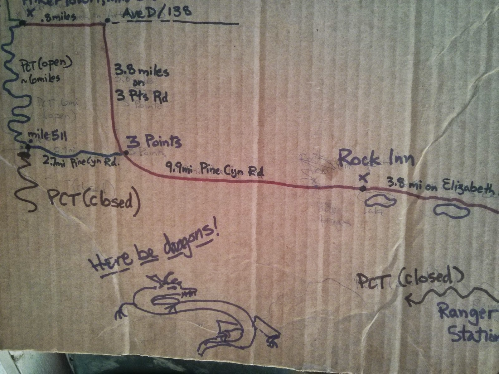
A schematic map of the Powerhouse Fire Detour
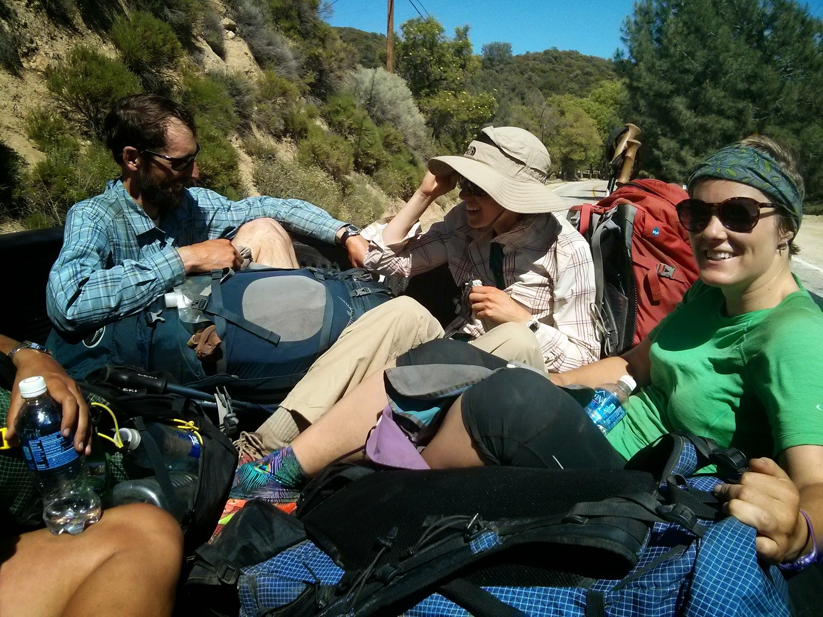
478.23-517.59 (San Francisquito Canyon Road to Highway 138) - This not-so-little skip was around the Powerhouse Fire Closure, which starts at mile 487.23 and ends at mile 517.59 (Or maybe at mile 510.95 on Pine Canyon Road - some people who did the road walk got back on trail over here). Walking the road around the closure is a long, 20.3 mile, walk (or a 19.2 mile walk to Pine Canyon Road, and another 6.64 back on the PCT, up to Highway 138). So we just skipped it.
Hitching a ride into Hiker Town
558.51-566.44 (Tehachapi Willow Springs Road to Highway 58) - This one was one of the most pointless skips I've made. No special reason to do it, other than how easy and inviting it was. We went into Tehachapi on the first road crossing (Willow Springs Road), zeroed there for a day, and headed out to the second road crossing (Highway 58). Thus - saving us about 8 miles of trail I'll never get to see again... Stupid of me.
766.33-767.00 (Whitney Spur Trail to John Muir Trail) - This is a short little bit we skipped, because we left the PCT and headed up towards Whitney on one trail, and then later got back to the PCT while hiking the the JMT from Whitney, which was a tiny bit further north on trail. I don't really consider this to be much of a skip.
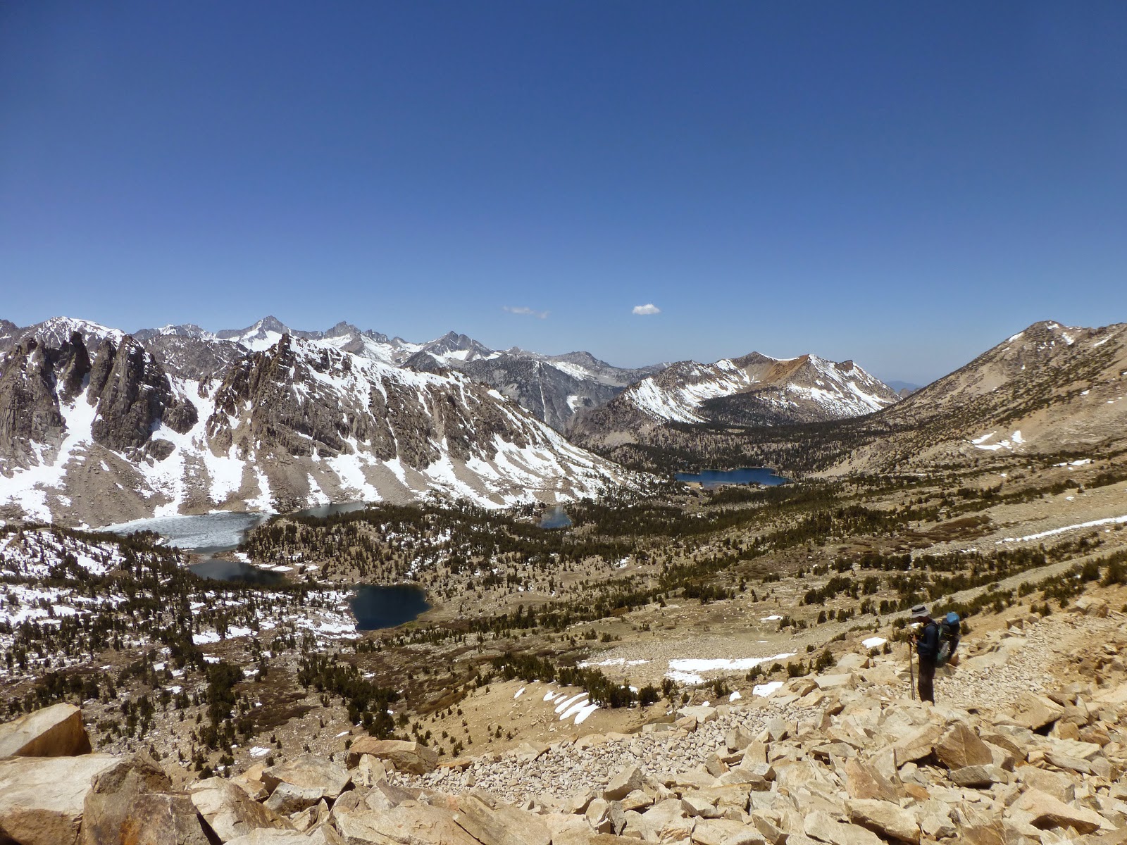
View back towards Bullfrog Lake, from Kearsarge Pass
788.47-789.08 (Bullfrog Lake Trail to Onion Valley Trail) - Another tiny bit. We hiked out towards Kearsarge Pass and into Lone Pine on one trail and got back on another one, thus skipping another 0.5 of PCT.
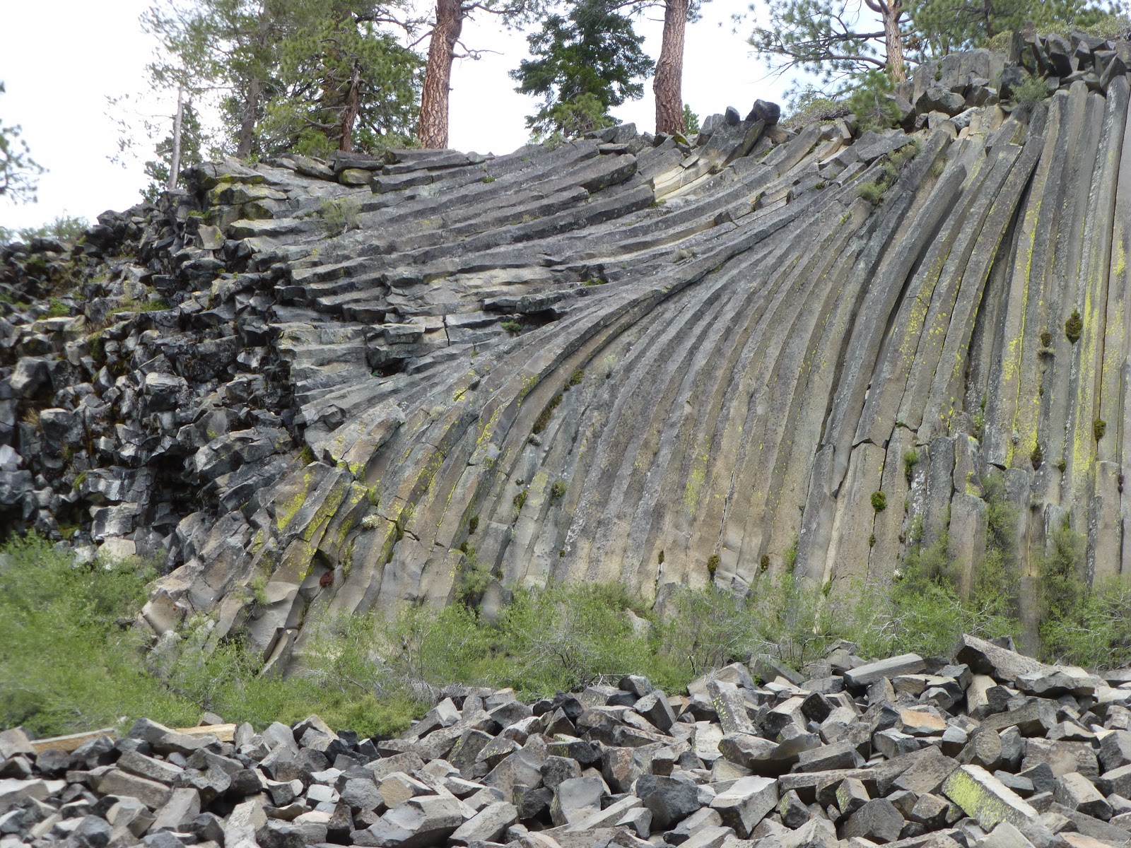
The Devil's Postpile
907.24-909.02 (Devils Postpile Alternate) - After leaving Mammoth Lakes through Red's Meadows, the trail goes by the famous Devil's Postpile. It's the same distance on the PCT and on the alternate, and I figured I might as well see it, since I'm that close. So we took it. It was nice enough.
909.02-922.92 (JMT Alternate) - Right after getting back to the PCT from the Devil's Postpile alternate, the PCT and JMT split for a short section. Here, also, both alternates are almost the same distance, but the JMT section is supposed to have some nicer hikes around lakes, and is generally considered more beautiful. I wouldn't know - I just hiked the JMT. It was a nice enough section, and we had a lovely day.
940.84-942.50 (Tuolumne Campground Trail to Highway 120) - Since we were planning on heading down to Yosemite Valley, to finish up the JMT with Yair, we cut over to the Tuolumne Meadows campground when we reached the intersection. Two days later, when we took the bus up from the valley, and back to the store, we kept on hiking from the highway.
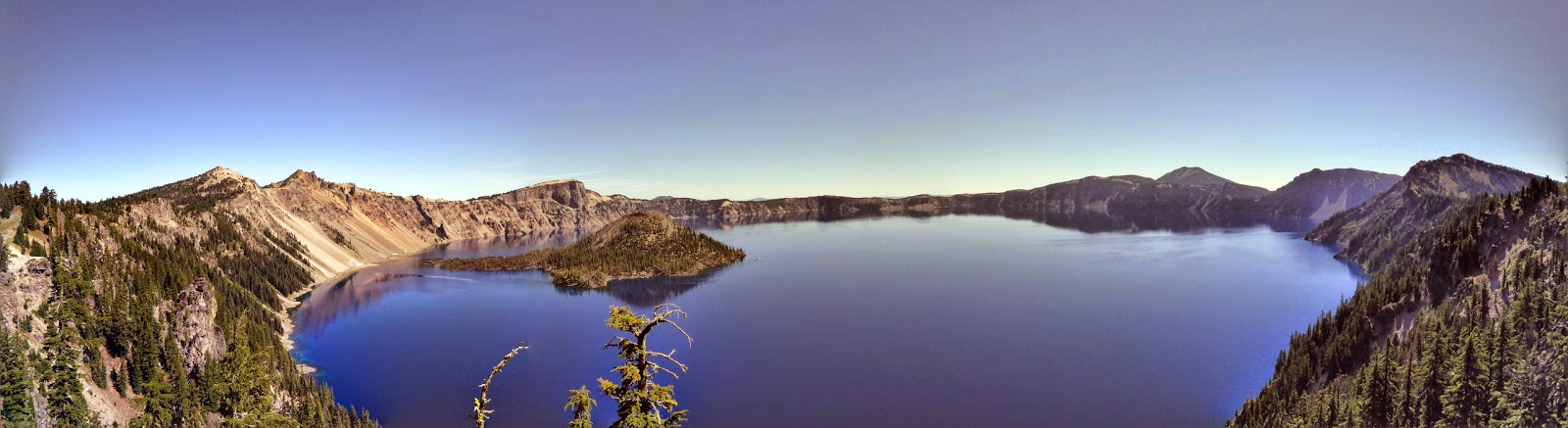
I think it was worth the detour...
1831.54-1843.62 (Crater Lake Alternate) - I don't think there is any PCT hiker who doesn't hike along the Crater Lake Rim Trail. So I don't really need an excuse here. It's the de-facto PCT. So much so, that the mileage marks on this detour, and further up the trail, take into consideration hiking on the Rim Trail, and not hiking on the official, equestrian trail.
This wasn't that impressive, in my opinion. I kinda reminded me of Amicalola Falls, near the start of the AT.
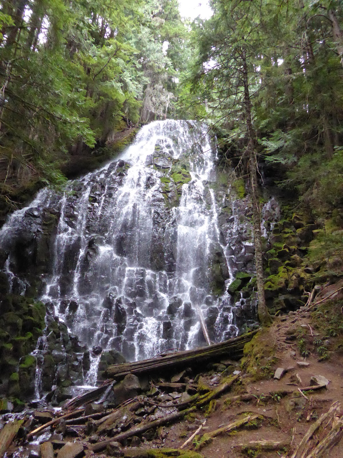
2117.22-2119.33 (Ramona Falls Alternate) - Another tiny alternate, that goes by Ramona Falls. The distance is identical to the official PCT, and I think the trail was changed here to bypass the falls, mostly because of equestrian hikers. I figured that since I'm going to hike the Eagle Creek Alternate on the following day, I can be just as "unpure" on this day, and see some more nice falls. I wasn't too impressed with the falls, at the end.
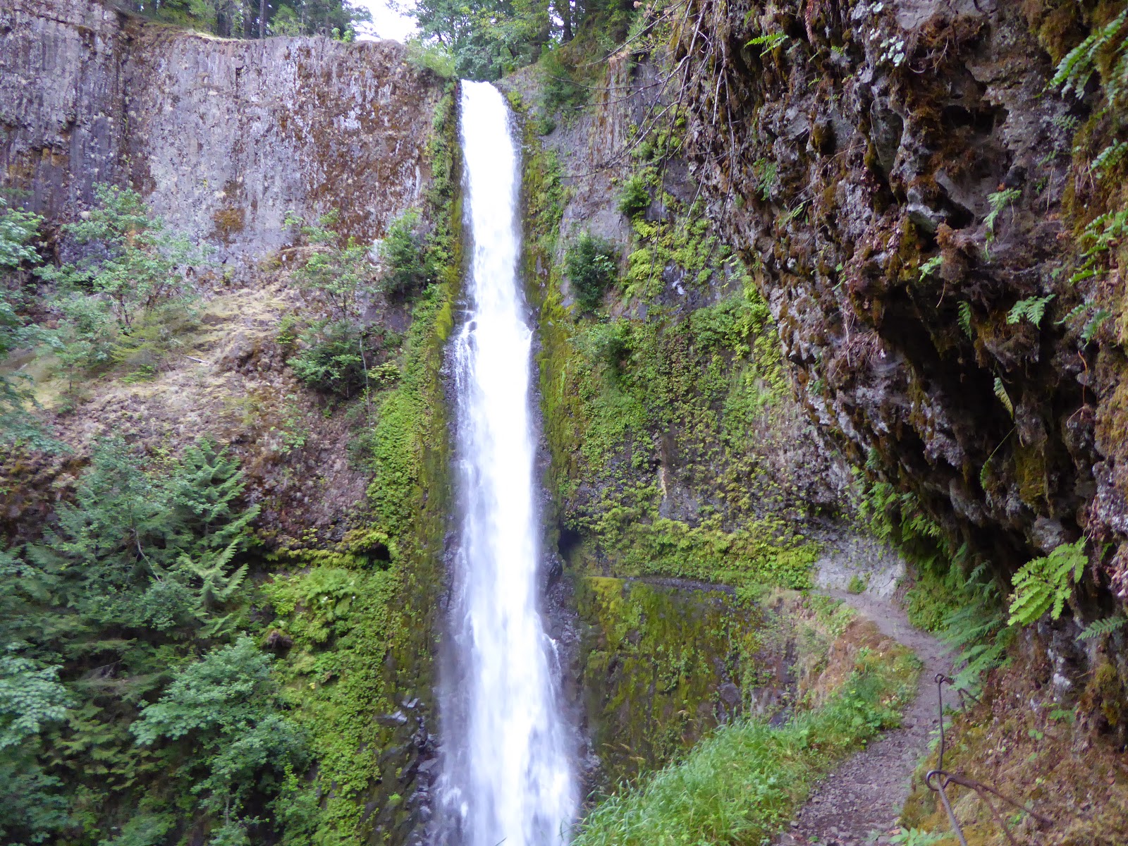
And the famous Tunnel Falls
2138.06-2154.70 (Eagle Creek Alternate) - Another de-facto PCT. Going down towards Cascade Locks (And the Oregon/Washington border) on the Eagle Creek Alternate is what "everybody" does. The giant waterfalls are very special, and give a nice touch to the trail, before entering the final state. Don't miss it.
In total, I didn't hike over 144.03 miles of the trail, which is %5.41. If I only include sections I hitched around (as opposed to hiking on alternates), I skipped 90.72 miles (%3.41). Maybe I'll come and stitch it all up, some day...

Thursday, December 25, 2014

My Post Hike Gear Review (Pt. 3 - Misc)

(My complete gear list)

Trekking Poles - Gossamer Gear LT4s/Leki Quantum

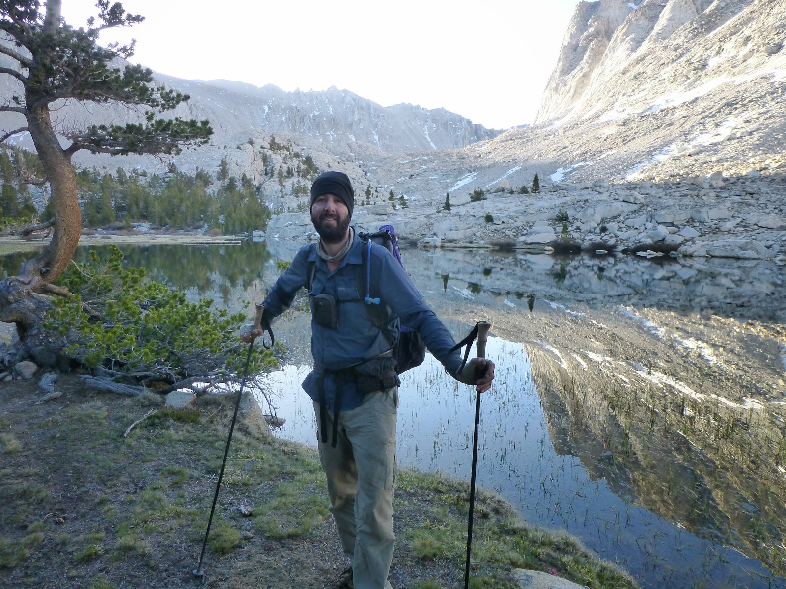
I started my hike with a pair of Gossamer Gear LT4s trekking poles. They are made of carbon fiber, and are very light indeed. I was worried that the lack of shock absorbing will bother me, but I quickly got used to them, and they've been very useful on the trail.
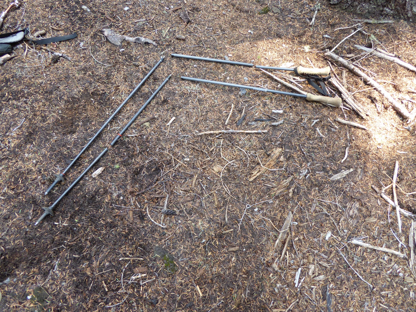
They did work, for a good 2/3 of the trail
The biggest problem I had with the poles was theie locking mechanism. It seems simple enough, and it almost never failed on me while hiking, but whenever I wanted to adjust the length (every evening at camp, to extend them so that my tent would be wide enough, and every morning, to retract them back to hiking length), I had to fight with the mechanism, twisting and turning, pushing and pulling. It was a real pain in the ass, and I finally gave up and ordered 4 tent stakes, so I could set up my tent without fiddling with the poles. That solved that problem, but it was still annoying.
Another problem I had with them - the tips are wearing down really fast. I contacted GG support when I was in Lake Isabella (Mile 561) and ordered tips to Lone Pine (Mile 788), where I replaced one tip. I replaced a second tip in Quincy (Mile 1269), and another in Ashland (Mile 1726). All the while, Idan was still using the original tips he used from the start, and they were just starting to show some wear.
Coming out of Lone Pine, I managed to snap one pole's lower section while post holing. Admittedly, while stumbling through the snow I stepped on the pole. But it did snap easily. I had to order a replacement to Mammoth Lakes (Mile 906). Coming out of Ashland, I just had a little stumble over a root on the trail (I didn't even fall to the ground), and again I snapped a pole. I was thinking of buying another section (GG offer no warranty on the poles), but then I snapped the second pole on the following day (This time I did end up flat on the ground). Luckily - I had one snapped lower section, and one snapped upper section. So together I still had a full pole to carry me all the way to Cascade Locks (Mile 2155). Coming down into Cascade Locks on the Eagle Creek (steep) alternate, I finally snapped my pole again. No GG poles for me in Washington!
But then they snapped. Notice two broken sections, out of the four.
I left the one intact pole section I still had at the Cascade Locks Post Office (I hope someone found it useful), and bought a pair of cheap and heavy Leki Quantum poles. It took me a long while to get used to the weight difference, and I never quite liked them. But they did the trick for the remaining 520 miles of trail. And they were also very easy to extend and retract, so I even used them for my tent for a couple of nights.
Next time I'll just buy a pair of Black Diamond carbon fiber poles, like Idan had. They seemed light enough, but much sturdier than my GG.

Stove - SnowPeak Titanium LiteMax

A long time ago I bought a Caldera F-Keg system, and used it for short trips in Israel, and for my Israeli National Trail attempt. I really liked it simplicity, and I enjoyed cooking on alcohol. I never cared much for the time it takes to boil water. I don't mind waiting a few more minutes.
But, my plans had to change - because of the drought in California there were many rumors about which camp stove is permitted on the trail. There were some people claiming that alcohol stove is still legal, but I figured I'll give gas stoves a try.
I found the LiteMax at a sale in Sierra Trading Post for ~$37, so I grabbed it. Idan had an identical stove, and pretty quickly we figured out we can boil enough water for both of us on a single stove every evening, so we just carried one of them until we split up. The stove worked very well, and got the water to a boil fast enough for me. Though seeing other people using JetBoil I admit they were much faster. As I said - it was never an issue for me.
I was planning to switch to my alcohol stove when I enter Oregon, but when I got there I decided I'd stick with what worked out so well for me. So I used the LiteMax for the entire trail.
At the end, several of the tiny screws were a bit loose (one was missing). An email to SnowPeak, and they just sent me a small envelope with brand new little screws. That's all I needed. Good customer service!

Pot - Evernew Ultra-Light 0.75Liter

Even though I ordered the 0.75l Pasta Pot (or is it 0.7l? I'm not sure) from Trail Designs, I got the 0.6l Pot instead. I was afraid it won't be enough for me, and Trail Designs replaced it for me without a problem. In retrospect, I think the 0.6l one would have been enough as well.
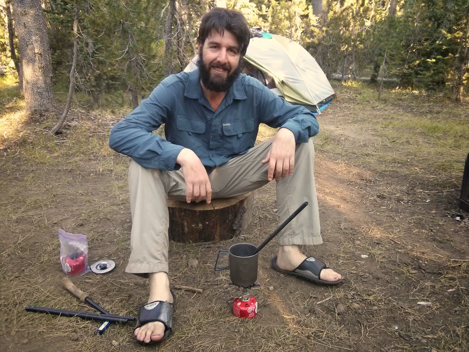
Stove + Pot + broken GG poles. The best method to get the tips off.
The pot can easily fit a small gas canister, including my LiteMax stove and a small lighter. It held enough water for me to boil for lunch. I guess that's all I need in a pot. I never cooked in it (Except for instant mashed potatoes, if you call that cooking, once or twice), so I also never had to clean it. It did the trick.

Spork - Sea to Summit Alpha Light long spoon

I have a couple of Light My Fire sporks back home, but the first thing I noticed when I landed in San Diego was that I forgot them behind. So I bought a long spoon at REI. I was very happy with it being a bit extra long than normal sporks/spoons, as it allowed me to easily eat directly out of the Knorr bag I was having for lunch that day. It was also nice having a flat ending, to easily scrape the bottom of the meal. I never felt like I needed a fork or a spork instead.

Hydration - Platypus Big Zip 3L/Smart Water bottles

I have the older model of the Big Zip (without that Low Profile thingie), but I really enjoyed it on the trail. I find drinking from a tube much easier than having to pull out a water bottle, and put it back in the side pocket afterwards.
I carried the platypus inside my backpack, using the hydration port to pull out the hose, but in the Sierras I had my bear canister taking up too much space inside, so I moved the water bag to the outside mesh pocket. It was much more comfortable for me there, so I kept on carrying it on the outside from that point on.
I had the bag freeze on me once in the Sierras, at the morning before climbing up Whitney. It wasn't that bad - the ice thawed quickly enough, and the most annoying bit was the frozen hose, but the biggest issue was that it caused a small tear in the bag, and it was leaking slightly all the way to Lone Pine (about 3 more days). In Lone Pine I tried replacing the bag, but I couldn't get in touch with Cascade Designs in office hours, so I ended up putting a Compeed sticker over the tiny hole, and it held out fantastically all the way to Canada.
I bought two 1 Liter Smart Water bottles down in San Diego, right before starting the trail. I chose Smart Water because I heard the bottles last long, and they fit my Sawyer Mini filter. I used them all the way to Tehachapi, where I replaced one bottle with a 1.5 Liter bottle. A bit later I ditched that one also, and from the Sierras I only carried one 1 Liter bottle on me (along with the 3 Liter Platypus).

The bottle held out very well, and I actually carried the same one all the way to Canada. I still had a hard time finally throwing it to the bottle recycling bin back home in Tel Aviv, a few weeks after I got back home. But that was just me being overly attached to my gear. While the threads did get a bit dirty, and needed the occasional cleaning in hotel rooms along the way, the rest of the bottle was in perfect shape and didn't leak or burst. I was very happy with it.

Water Filter - Sawyer Mini/Aqua Mira

I bought the Sawyer Mini filter right before starting the trail, hearing many good things about it. I really liked its compact design and weight. I never used the little hose, and the packaged 16oz squeeze bag was also very unhelpful. It's almost impossible to fill the bag up from a stream, and I found it much simpler to just fill up one Smart Water bottle and squeeze it into another one.
Quickly enough I lost one of the rubber bands that should keep the filter from dripping from around the threads, so I had to squeeze the bottle and make sure the drops don't get into the "clean water" reservoir.
A bit later, we started using Aqua Mira to clean our waters as an extra step after filtering them. It was just before entering the Sierras, and Idan insisted that the water there might be a boot polluted, and filtering might not be enough. After about two days of this dual-filtering, I just gave up and started just using the chemical treatment, and not filtering at all - most water sources seemed so good, I didn't feel any need for further filtering.
As the hike went on, and I got complacent, I slowly started skipping the purifying bit on more and more water sources, until I also ditched the Aqua Mira drops completely. I just drank all the water directly, and never had any problems. I can not recommend this method at all to anyone else. It is probably the most stupid path to chose. But it worked for me.

Gloves - some unknown brand/Sea to Summit Eclipse Paddling Gloves

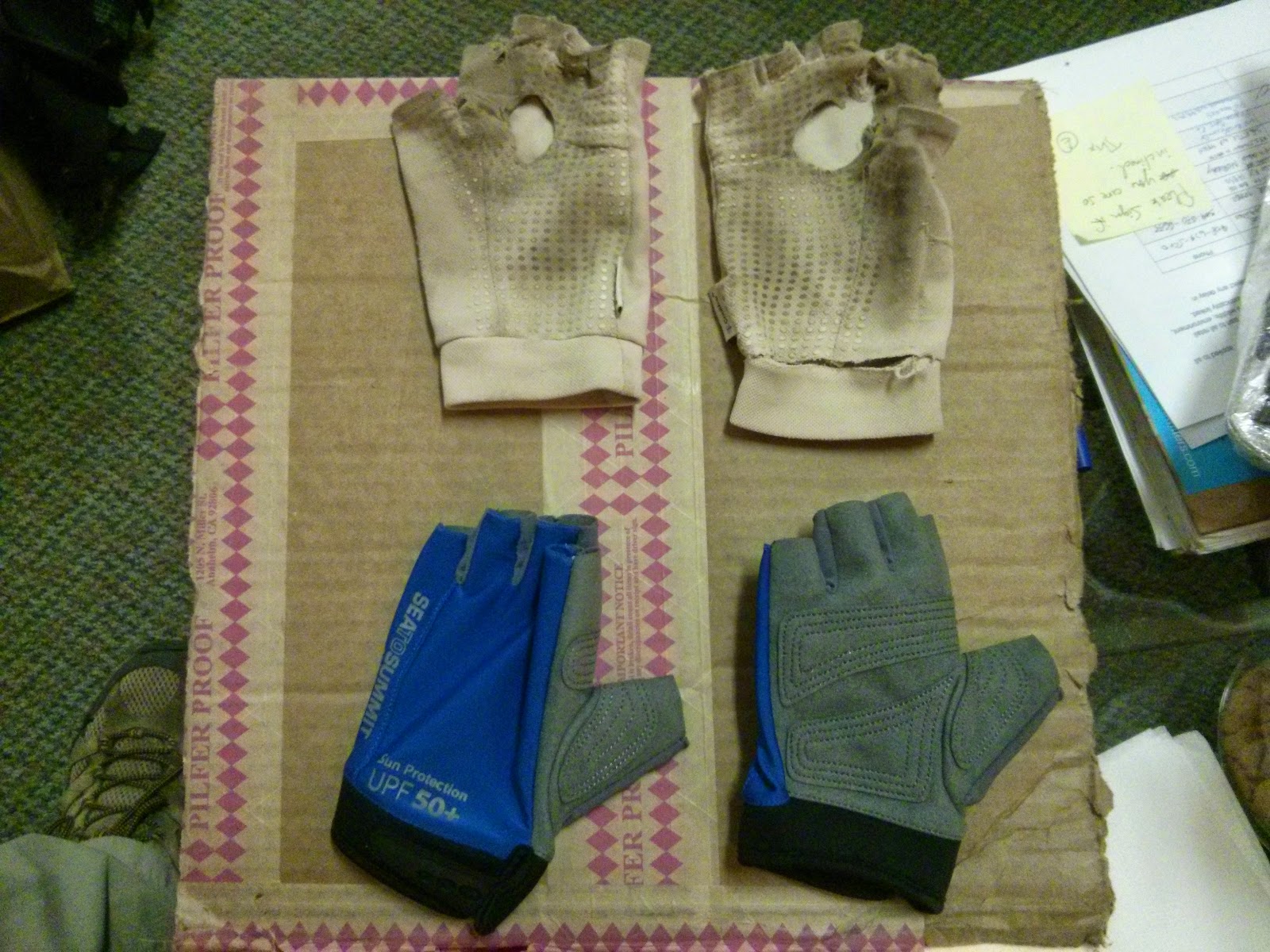
On my third day out, I bought a pair of sun gloves at Dave Super's gear store in Mt. Laguna. I just bought the cheaper brand gloves over there, but I really liked them. They were light and airy, with an actual hole at the palm of my hand, and cut-off fingers. They were very comfortable, and lasted almost half way up to South Lake Tahoe (mile 1093).
Old vs. New
In Lake of the Sky Outfitters I bought a new pair of sun gloves, this time going for the Sea to Summit pair. I didn't like that pair as much, especially the hard leather bit on the palm side, which was not comfortable, and a bit too hot sometimes. They were also a bit harder to take off. I recently found out it's made out of fake leather, which is a comfort. They did hold up nicely all the way to the end, and worked well in protecting my hands from the sun.

Camp Shoes - cheap flip flops

I just carried a pair of cheap, simple, flip flops I had for hiking for several years. The right flip tore up right after leaving Tahoe, but I managed to carry it all the way, with the help of some duct tape emergency field repair. It worked. I actually carried them back home to Israel, and threw them to the trash bin next to my house.

Towel - PackTowl UltraLite

Not very handy at all. I thought I'd carry it in case I want to dry off after a quick shower someplace, but almost every place that had a shower, had a normal towel I can borrow. I think I actually used it to dry myself off less than 5 times. I did use it occasionally to dry the inner walls of my tent in the morning, after a damp night. That was useful, at least.

Headlamp - Petzl Zipka 2

I have an older model of the Zipka (called Zipka 2, oddly enough), that has a red colored LED in addition to the standard white one. I really liked the red option for rummaging around my tent at night, or a quick excursion to the woods in the dark. The batteries do last a long time, especially since I didn't use the headlamp that much (probably an average of ~1 minute every night). I didn't night hike on the trail. I just made sure to keep it next to me, when I went to sleep each night. In case I'd need it.

Knife - Victorinox Tourist

I think I had this model. At least - I had the same tool set on mine. Anyway, I didn't use it much. The big knife was nice to cut cheese (I learned the hard way that this is a euphemism to farting), and cutting open my care packages. The small scissors were also nice to have occasionally. I could have easily managed with a smaller version (And even considered buying one, but then thought $25 is too much for such a minor weight difference), or even without any knife at all.

Solar Charger - sCharger-5

I bought the sCharger-5 along with the "Emergency Kit", mostly just for the included external battery. I have the older model of the panel, so I drilled holes in the corners myself, in order to secure it to my backpack while walking. I didn't really use the charger on the trail much, using the external battery (next section) during most sections.
Only in the two long sections of the Sierras (each one was 7 days between towns/electricity) we really had to use the panels. After I realized I am carrying it on my back and never actually using it, I sent it away, and kept on relying on the external battery.

External Battery - Lepow Moonstone 6000/Anker 2nd Gen Astro

I started my hike with the Lepow battery I got from Suntactics. It has 4 LEDs that show the current state of the battery. After several weeks on the trail, I noticed that the LEDs go from 4 (full charge), down to 2, and then the battery appears dead. As if it can only contain half the charge. Once I got to South Lake Tahoe I emailed Lepow and asked them about a replacement. In Mt. Shasta I realized I should contact Suntactics, as they were the re-sellers of the battery I got (Lepow didn't even know who I am talking about), and they (Suntactics) immediately agreed to send me a replacement battery to Etna (It was really easy - just a web chat away with Suntactics customer support).
Sadly, the battery I got in Etna had the exact same problem - LEDs going down 4->3->0. I just went into Amazon, and ordered an Anker battery. It's a brand and model I saw other hikers use, and it was smell and lightweight enough for my tastes.
The Anker worked perfectly. Helping me keep my phone with enough power for 4-5 days between towns, and that's on top of an old phone, with crummy battery. So I was happy.

Camera - Panasonic TZ20/TZ40

I started my hike with the TZ20, a bit of an older model from Panasonic. I mostly liked the GPS feature, allowing me to keep track of where I took every picture. It is sometimes annoying, when I pull the camera out and turn it on, and have to wait for the GPS to get a fix. Sometimes I had to wait for several minutes, though most times it would get a fix in less than 20 seconds.
I also really liked the X20 zoom I had, which allowed me to take nice photos of distant mountain tops (I rarely used the full X20, but it did give plenty of room to play with). I never really played with the different camera options, just shooting on "auto" all the time.
The camera got a bit wet right after the half way point near Chester, and stopped working. I sent it to some lab from Mt. Shasta, but they sent me a repair quote of ~$160, so I told them to just send the camera to my home base, and later just bought a newer camera from B&H, to Ashland. One side effect is that I don't have many good photos of Northern California. Oh well.
The new camera was just a more updated model. Same GPS functionality, but this one also has Wi-Fi. The Wi-Fi option is a bit sketchy - you can't transfer more than 10 photos to your phone at a time, so whenever I reached town, I'd copy them in small batches. It was annoying, but at least it was much easier than before. Now that I'm home, I tried setting up auto transfer from the camera to my home computer, I still couldn't get it to work. It's very buggy and not well documented.
But the camera itself does feel a bit better than the previous model. Now with X30 zoom, there's even a bit more zoom to play with. I still shoot on "auto", and I am happy with the results.

Smartphone - Google Nexus 4

I took my phone from Israel with me for the hike. Being a GSM phone I knew it would work well with AT&T and T-Mobile networks in the USA. I managed to get an unactivated T-Mobile sim card beforehand, and when I landed I activated it on a pre-paid plan for $30/month for calls+data.
Pretty soon I discovered that I didn't have a lot of reception on the trail, especially compared to AT&T reception. I decided to switch to Straight Talk, an MVO that operates over AT&T network and offers a prepaid monthly option as well. for $45 I Got unlimited national minutes, and 3GB of data. I also used Google Voice to call home (international), so having national only minutes didn't bother me. The reception was all right throught most of the first half of the trail. Up in Oregon I had a bit less, and almost no reception in Washington. Verizon has much better reception up there, but they are not compatible with my Israeli phone, so they were not an option for me.
I used many different Android apps on the trail, on which I'll elaborate further in a future post. But having a smart phone was definitely a good call for me. It was very handy and useful, and I'd highly recommend it.

Friday, December 19, 2014

My Post Hike Gear Review (Pt. 2 - Clothing)

(My complete gear list)

Hiking Shirt - Columbia Silver Ridge Long Sleeve Shirt

I think I wore that shirt every single day for my entire trip. So it's 152 days on trail, adding a couple of days before I started, down in San Diego. That's pretty impressive.
On the trail, I always wore long sleeves. I don't recall a single time I folded the sleeves up. Even in the hot desert, it was never too hot for me. This way, I also didn't use any sun tan lotion for most of my hike - with arms and legs covered, and having a buff over my neck, I only rarely put some on my face. That was a big bonus, as putting on sun tan lotion is always a pain.
The material is very light and feels nice against my skin, and it dries quickly. The shirt was of excellent quality - I didn't have a single tear or seam falling apart. The only indication it was used constantly for 5 months is the way the color faded a bit. I would definitely wear a similar Columbia shirt for my next hike.

Hiking Pants - Columbia Silver Ridge Cargo Pants

Same as the shirt - Wore the same pair of pants throughout the trip, and I don't have any complaints about them. No tears, no seams falling apart. The only problem was my weight loss - I had to pull the belt really tight, and somehow manage the excess material around my waist so it won't bother me too much. I should have bought a smaller pair somewhere half way through, but I wanted to hike in the same pair for as much as I could. I'm silly that way.
Same clothes for the entire trip. They held up very well.

Boxers - Exofficio Give-N-Go

I had two pairs of those boxers, and I switched between them all along the trail. I admit I was not switching every day... It all depended on when the next laundry is expected, and how hot and uncomfortable I felt with the pair I was currently wearing. Through most days, they worked just fine, though I did have the occasional chafing and raw spots here and there.

Hat - Columbia Bora Bora hat

And here's the hat.
A very nice and comfortable hat. I think I can count on one hand the amount of days I didn't wear it (some rainy days up in Washington). Even in the blistering heat, I was never always comfortable with it over my head, with the small mesh allowing some wind to chill my head.
It took me well over 2 months to figure out I don't need the annoying string attached to it. I used to just put it behind my head (and not under my chin), figuring I might use it in some very windy conditions. But after hiking over half the trail without actually needing it, I finally cut it. The elastic cord around the head worked just fine for keeping the hat in place.

Beanie - ZPacks Micro Fleece Hat

I started without any beanie, and quickly discovered I am losing a lot of heat from my exposed head, during the night (My quilt doesn't have a hood). I bought the ZPacks hat at the ADZPCTKO for $10, and it did the trick. Warm enough for all the nights on the trail, and I also hiked with it a couple of times. Great value.
The Ghost Whisperer Anorak

Wind Shirt - Mountain Hardwear Ghost Whisperer Anorak

The link above is to the hooded jacket, but I had an older version, with no hood, and only half zip in the front.
I carried it with me for rain and wind protection in the first third of the trail, up to Kennedy Meadows. I figured I wouldn't have many rainy days in the Southern California desert, and I was right. I remember maybe 2 days of actual rain, and I probably put it on while hiking maybe twice more to protect me from some cold winds. It did the trick.
I now carry it with me every day, just in case a sudden rain will catch me unprepared. The minimal weight makes it very comfortable as a last resort.


Rain Jacket - Marmot PreCip

A great rain jacket, which I keep on using since my days on the AT, 12 years ago. In 2008 I bought a new jacket, since my old jacket was peeling on the inside, but I've used it since 2008 and on the PCT, and it performed wonderfully. I had just a few rainy days on the trail, and I really liked all the different venting options the PreCip offers to deal with different temperatures and rain types.
In the hot and rainy days of Northern California I sometimes took off my hiking shirt completely, and just put on the jacket. I admit - it doesn't really feel comfortable against the skin. But with the pit zips open, and the front zip also only part way closed, there was enough ventilation to prevent too much sweating, and enough protection at the top to prevent getting wet by the rain.
And here is the infamous PreCip
In the cold rainy days of Washington I used to close it all tightly around me. But it was still easy enough to open up the Velcro at the cuffs, to allow some air inside, or open the pit zips again a bit later, when the rain wasn't as strong, and sweat was starting to build up. It really does fit many different rainy scenarios.
I also used it in camp, at the evening, when it was not cold enough to put on my insulating jacket. And last but not least - even in the coldest nights, when I put on everything else to keep me warm, I'd keep the PreCip crammed inside its own pocket, and used it as a pillow.

Jacket - Mountain Hardwear Thermostatic Hooded Jacket

I was really happy with this jacket. Even at the desert, the nights were chilly enough for me, so I used it in camp on many evenings. It also performed well as a pillow, when I wasn't using the hood to keep my head warm. In some colder nights I wrapped the empty sleeves around my neck and shoulders. I think I Actually wore it during the night only once or twice.
Their down jacket is even lighter, but I figured I carried enough dead geese, and the synthetic insulation will hold better in case it gets wet.

Base Layer - Columbia/Marmot

I wore the base layer on most nights in my tent, and they kept me warm enough through most of them. On the colder evenings I'd put them on right when I got to camp.
I can't find the exact Marmot base layer pants I have, but both the pants and the shirt are nothing special. I think most light-weight warm-ish base layers would function similarly.

Socks - IceBreaker/Injinji

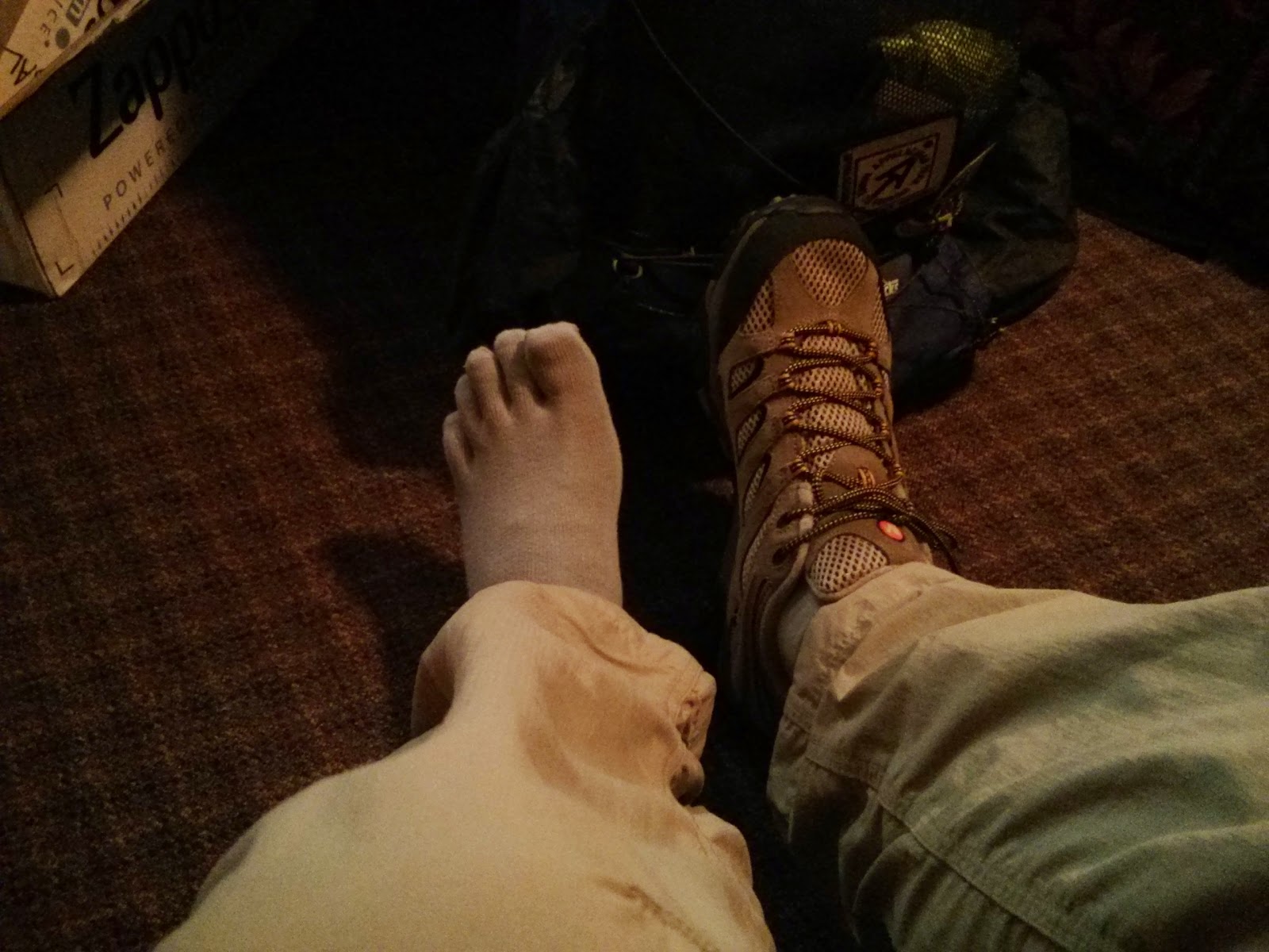
I started with two pairs of IceBreaker Hike+ socks, which worked just fine up to Wrightwood (Mile 369). They started having holes in them, so I ordered a three pack of Injinji's toe socks to there. It took a short while to adjust to the different feeling, but after a while they felt natural, and my feet didn't have any more serious blisters. I switched between the Trail and Run and whatever else models of Injinji, getting new socks in Lone Pine (Mile 788) and Belden (Mile 1289). I think the 3 pairs from Belden lasted all the way to the end. Impressive.

Shoes - Merrell Moab Ventilator

I started the trail with a pair of Merrells I used in Israel, and also hiked around the Mont Blanc with them. They were still in pretty good shape (~150 miles on them, I'd guess). I had some blisters at the beginning
New shoes and socks

Monday, December 8, 2014

My Post Hike Gear Review (The Big Three + 1)

(My complete gear list) I think it's about time I'd post some of my thoughts about the gear I used on the trail. I am quite happy about my initial gear selection. Most of my gear held on for my entire trip, with a few exceptions. I also ditched a few items I decided were not worth the weight.
Without further ado, here is my gear review:

Backpack - ZPacks Arc Blast 60L

Enjoying the view towards what should have been Alta Mountain.
The pack had plenty of room inside for all of my gear. In the Sierras I carried the BearVault 500, and it fit in easily. I had to strap my tent on the outside of the pack during that time, but it was still comfortable enough.
The Cuben Fiber worked perfectly for rain protection. I didn't have a lot of rainy days on trail, and only got completely soaked twice. On both times, though, all of my gear remained totally dry inside my pack. I never carried a rain cover, or inside liner. There was no need.
The belt pouch didn't have the best closing mechanism - at the beginning I had a tiny clip, which I couldn't close with one hand. I switched it to a Velcro version at the Kick Off, and it wasn't much better - The Velcro stopped working after a short time, and at the end I just used a rubber band to keep the pouch closed during the rain. The pouch was deep enough for me to leave it open most of the time, without worrying that anything falls out of it.
The Velcro at the top of the pack also stopped working after a while, but I was still able to close it tightly enough using the clip, so it didn't bother me much.
I know some hikers like to keep adjusting the straps and lift loaders after putting the pack back on. The straps are not easily pulled or released on the shoulder straps, or load lifters, but it didn't bother me much. I just found a setting that worked well for me, and didn't adjust the straps much for most of the trail.
The medium size belt I got was a bit too big for me, especially after losing 35 pounds on the trail, but it was still functional when pulled all the way tight around my hips.
All in all, I am very pleased with the pack. At the end of the trail it still performed well, and showed just minor wear. I have sent it back to ZPacks, and they repaired everything free of charge, and sent it back to me. Great customer service.

Sleeping Bag - ZPacks

I bought the 20 degrees quilt option, with only adjustable straps at the bottom (no zippers). I was a bit cold at the beginning of the trail, but it was mostly because of my sleeping mat (more on that later...). I also got the 850 fill water resistant down (I see they offer it in 900 fill now). I am not sure how much it would have helped in a crisis, but I just kept it packed inside its Cuben Fiber stuff sack, and it remained dry during my entire hike.
On the first few days, I could feel the heat escape through my head. I started sleeping with my down jacket hoodie on (usually without putting on the jacket), and later used my fleece beanie. That did the trick. On cold-ish nights I used both the beanie and the hoodie, and even wrapped the jacket's sleeves around my neck for extra insulation. In the really cold nights, I wore the jacket, of course.
I tried using the straps both directly under me (and over the sleeping mat), and also around the sleeping mat itself. The quilt was way too tight when wrapped around the mat, and it also felt less warm that way. At the end, during the cold nights I had in Washington, I just closed the quilt tightly around me, and it worked out fine and kept me warm.

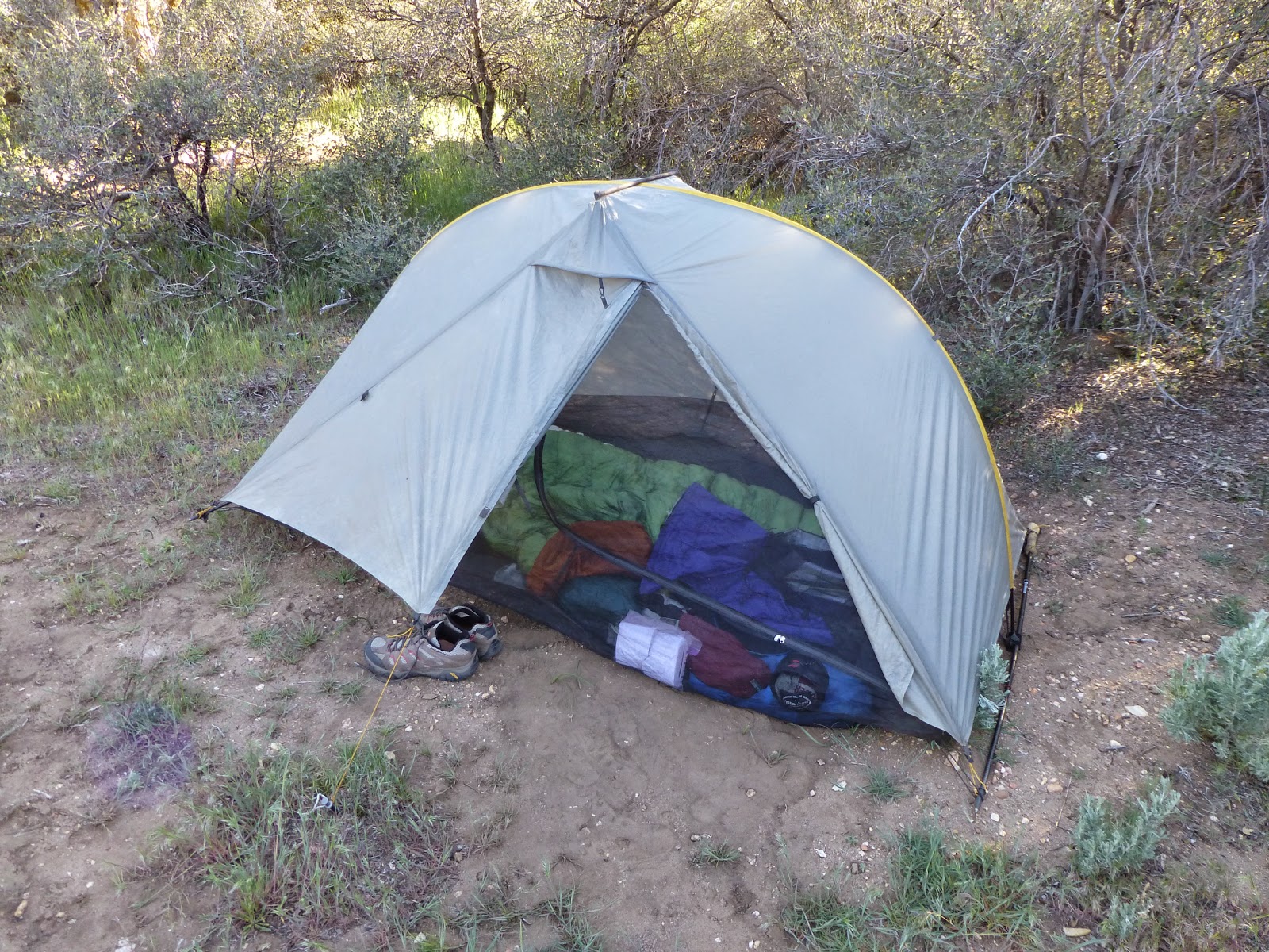
Tent - Tarptent Rainbow

My tent is a bit old (Bought around 2008), so it is a tiny bit different from the newer Rainbow model. But it's basically the same.
Everything I ever needed for my hike.
Before the trail, I used to set it up as a freestanding tent, using my trekking poles at both ends, and only using two stakes to secure the sides to the ground. I used it that way up until Kennedy Meadows (Mile 702), and it withstood some very windy and stormy nights with no major problems (As long as I was inside the tent, it remained on the ground).
I had a small tear in the Velcro used to secure the trekking pole to the tent (The new model have a different mechanism there), and Henry Shires fixed it for me at the Kick Off. He also sent me a replacement pole section for a section that seemed like it was going to snap soon. I had another pole that seemed just as bad later on, but it held out until the end.
Another problem I had with the tent was with the zippers - the netting zippers stopped working one after the other, and the one on the outer fly as well. The outer one wasn't very important to me, since the Velcro over there did the trick. But the netting zippers were very annoying. At first, I tried cleaning the zippers with some oil, and using a pair of pliers on the sliders, and it worked for a short while. When I got to VVR it kinda gave up, and I emailed TarpTent and got them to send me extra zippers to Toulumne Meadows. But before getting there, while resting in Mammoth Lakes, I went over to an awesome local seamstress that replaced one zipper for me, and kept me going with it all the way to Burney.
In Burney, after a terrible night with effectively no bug netting at all, I finally tried using the sliders I got in the mail, along with zipper stoppers I found at the local seamstress shop, and replaced both zippers on the netting. This time it all held all the way to the end. I think in Bend I finally fixed the rain fly zipper as well.
My trekking poles' mechanism was not very comfortable to adjust, and every evening I had to fight both of my poles just to extend them a bit, and then once more in the morning. Before entering the Sierras I gave up on setting up the tent in the free standing style, ordered 4 Easton stakes, and used them for the rest of my hike. It was worth it, for sure.
Many people worry about condensation inside tents, especially in single-walled tents such as TarpTents and ZPacks. What I liked best about my Rainbow was its size - even on damp and wet nights, when it was covered in dew, both outside and inside, my gear would never touch the inner walls, and would not get wet. In the morning, I would just pack my sleeping bag and mattress while inside the tent, move everything outside, and then try to dry as much as I can on the inside of the tent, using my camp towel. I would then just pack the tent, and only unpack it in the evening, on the next camp site. I never bothered spreading it to dry at noon, or had my sleeping bag get wet during the night, or any of those water/condensation related problems.
In conclusion, it was a great tent, and I was very happy with it. I highly recommend it.

Sleeping Mat - Therm-a-Rest Neo-Air X-Lite small/reg

I started my hike with an older Neo-Air, size small. I bought the small one because I used a small inflatable foam mattress back on the AT, and it worked well for me back then. But the Neo-Air was not as good this time.
At the beginning of the trail I had plenty of cold nights, and I thought that's just the way it's going to be. But pretty soon I was wearing everything I had during the night, and wrapping my jacket around my feet (which felt the coldest during the night). After entering the Sierra's, and realizing both Idan and Yair are much warmer during the night, Yair finally suggested that maybe my mattress is not good enough. The theory was that because I have a sharp drop from the mattress, just under my knees, and because I was sleeping in a quilt, which is open underneath me, cold air is entering freely into the bag during the night.
That first week out of Kennedy Meadows I stuffed unused rain gear under me, around that hole between the mat and the quilt, and it seemed to improve my sleep temperature. When we got to Lone Pine I just bought a brand new normal sized Neo-Air, weighing at 450gr (~80 more than the small), and only a bit larger.
Since then, I was quite happy with sleep system. I am sure I had some pretty cold nights further on the trail, but I only remember one more night of "wearing everything I have", and most nights I was warm enough inside my quilt.
Regarding the comfort level of the Neo-Air - it's awesome. I twist and turn through the night anyway, but the mattress worked fine when sleeping on the side, as well as on my back.
Many people complain about the rustling noise these mattresses make. It never bothered me. Not the noise coming out of my own mattress, nor the ones from nearby hikers (And many others do use the Neo-Air).

Tuesday, September 30, 2014

Into Manning Park and beyond

It was cold at night. Not the coldest it has ever been so far, but cold enough. My sleep was as usual - not sound. But I'm used to it by now. When the alarm went off at 5:00 I was relieved to finally start my final day of hiking.
Last night I learned that the bus to Vancouver doesn't go through Making Park at 11:15, but instead goes by there at 10:10. So I needed an early start to get there even earlier than I thought.
I also forgot to do two things at the monument - I forgot to drop the stone I got at Big Bear, around mile 266, on the lowest time I had on the trail. I also forgot to have a photo by the monument with the letters I received from the 7th graders, in the care package Idan and I got from Helen. It was time to do those two things in the morning.
It was still completely dark outside, and the tent was damp. I didn't mind. I won't be sleeping in it anytime soon. I packed up quickly, because Lighthouse wanted to move out for his 30 miles day as fast as he can. We walked together to the monument, and got the photo with the letters. My camera decided it was the proper time to have no battery, so we used Lighthouse's phone instead. I also left the stone inside the monument.
We hugged and went our separate ways, and Lighthouse started his long journey back to Hart's Pass, while got back to the campsite to finish folding my wet tent and head out myself. I finally left camp at 6:00. Early enough.
My fingers got really cold at first, while I was hiking in the darkness with my headlamp. I held my hiking poles under my arm and put my hands in my pockets. That helped, though it slowed me down. Eventually it got a bit warmer, so I started hiking normally.
I found it strange that the signs still called this trail the pct. Right at the campsite where I slept, there was a sign with an arrow pointing south, to "Monument 78", and another arrow pointing north to the "PCT". The Canadians got it all wrong.
The Canadians got it backwards
The trail climbed up for a few miles, to the next campsite, and finally reached a dirt road and started the long descent down to the park. It was mostly an easy walk, and I got to the final section, of the paved road, just as Red Light got there. We walked together and reached the lodge at 8:45. Plenty of time before the bus comes.
We heard we needed to buy tickets for the bus online, so we hurried to the main building to get the Wi-Fi and to ask about it. We found out you can't buy tickets online so close to the arrival of the bus, and that we'd have to get on the bus, and pay at a later stop. OK. I did manage to sneak in a few Wi-Fi moments to send my wife a message I have finished the trail. That was the most important thing.
Idan walked into the lobby. He got here yesterday, and spent the night at the hostel. We both congratulated each other for the completion of our journey. I wanted to try and grab a quick shower at the hostel, so after asking around I went looking for it. I failed miserably, but a park employee stopped by with his car, and told me I could shower in the swimming pool for $5. He gave me a ride back to the lobby, and I finally got my shower. That was nice.
I still had 40 minutes left until the bus came, so I had the breakfast buffet at the restaurant. Eggs, hash browns and pancakes. I'm going to have to stop eating like this soon. The bus came around right on time, and I got on it, along with Idan, Darwin and Red Light. We had to leave an ID with the driver, until our next town stop, where we bought the tickets to Vancouver. Apparently, the Greyhound office over there is located inside a bowling alley.
After a long ride to Vancouver, a long wait at the bus station there, and another long ride to Seattle, I finally reached it at 22:15. It was tiring. Frank picked me up from the city, and into his and his wife’s Nancy house in Redwood, where I crashed for three nights. I later crashed for three more nights with Yulia, Dima and Nick in Bellevue, before finally taking off back to Israel on the 20th.
I toured around Seattle a bit in that week, just sight seeing the down town area on foot. I met up with Lighthouse for a couple of days, and also bumped into Rock Ocean, just as he was bringing in Ball Buster, Tick Tock, Slaughterhouse and Dewey from Hart’s Pass. We even had a short sailing in Elliot Bay.
Sailing in Elliot Bay
All in all I think I had plenty of relaxing time in Seattle to ease me back into society. I also had another week back home before getting back to work, so I currently don’t feel too weird or out of place back in the big city. In fact, I sometimes feel weird about how not weird it all is, like driving a car, or walking around Tel Aviv.
Back home after a very long trip