We woke up at around 6:00, and already every one else were gone. Almost every body on the camp ground were heading
up to mount Whitney, and they wanted an early start.
Because of the cold, we had a bit if a late start ourselves, since we waited for the sun to rise over the enclosing
cliffs, and warm us a bit.
Idan's foot was hurting, but he was hiking like a pro, and leaving us both behind on the climbs. It was really
impressive.

|
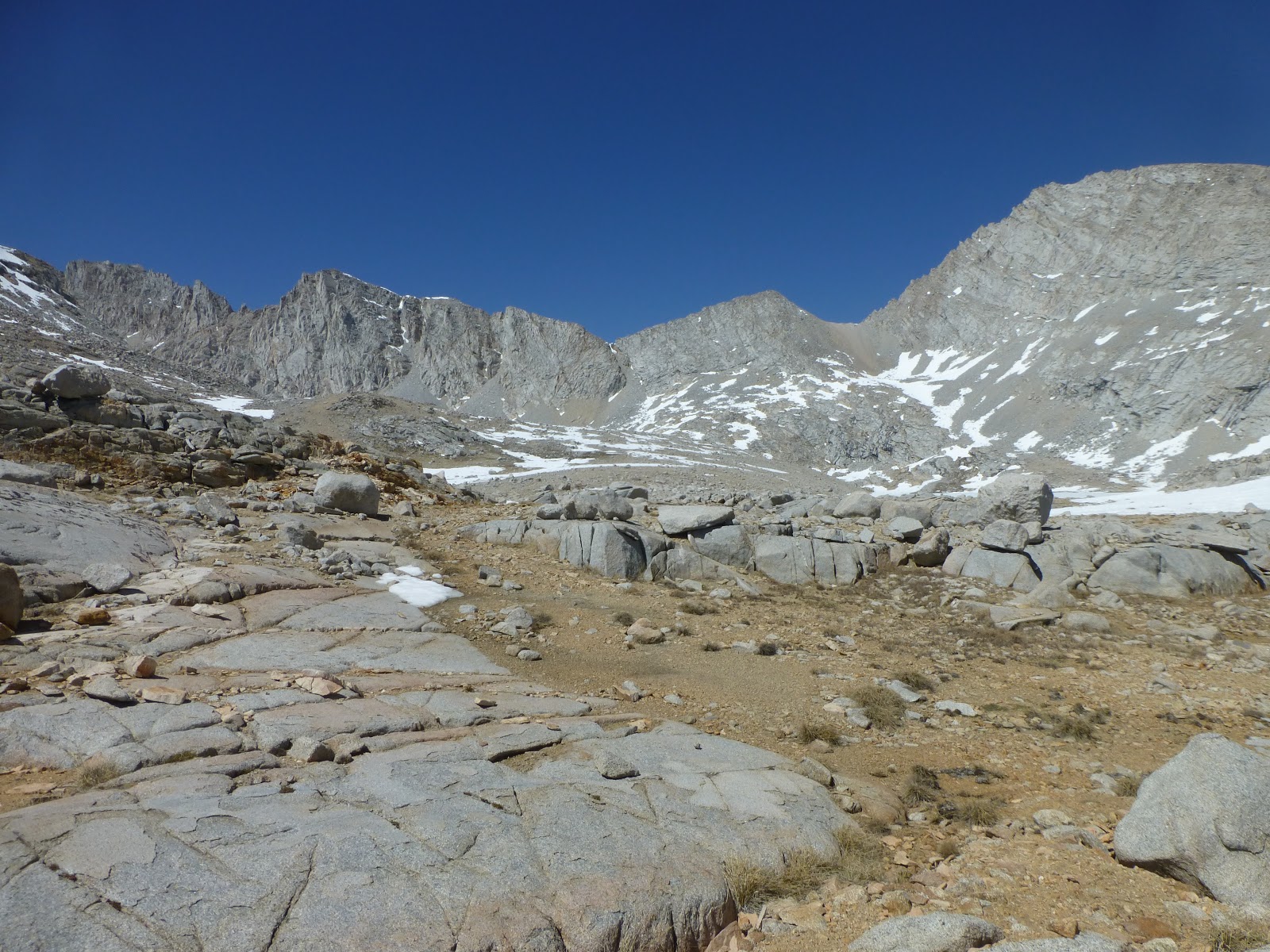
| This is *not* Forester Pass. It took us about an hour to realize we are not heading towards it. |
We kept looking at "Forester Pass", and were wondering why the trail does not take us in its direction. It took us a
while to realize we were looking at the wrong direction and the wrong pass. The real Forester was directly ahead of
us.
We had 3 stream fords today. Nothing serious, but on the 2nd one we just walked in the stream, as we couldn't find a
decent path to cross over stones. We just walked in wet shoes and socks for the rest of the day.

|
| This is Forester Pass, dead on in the middle of the photo. |
The climb up was long and slow. Then the snow patches came. We managed to walk around some of them, and slowly
walked through some others. This was still before the steep climb to to the pass, so it was not too dangerous
yet.
I kept wondering how snowy the northern side would be, and then we met a couple of hikers coming towards us from the
pass. I asked how much snow there was on the other side, and was not happy to hear "there's a lot of snow" as the
answer. Damn it.
Then came the switchbacks up to the pass. It was hard to see where they started, but we had several snow trails to
choose from, so we picked one and headed up.
At the lower switchbacks, half the time they were buried in snow themselves, so we just cut through them and kept on
climbing up level after level. The upper ones were clearer, so we trudged along slowly. Idan was still in the
lead, hiking fast and strong.

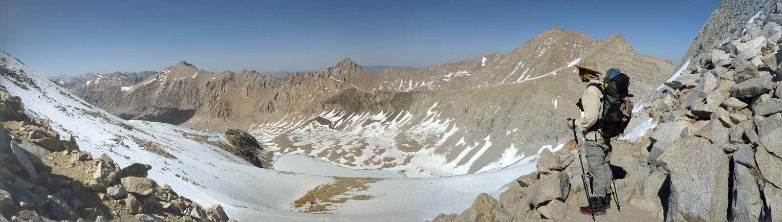
|
| And this is the view north, from the pass. |
After finally reaching the icy chute at the top of the pass, we were relieved to see the small switchbacks up it
were clear. We climbed them to the top, and didn't have to mess with the ice steps cut into the chute.
|
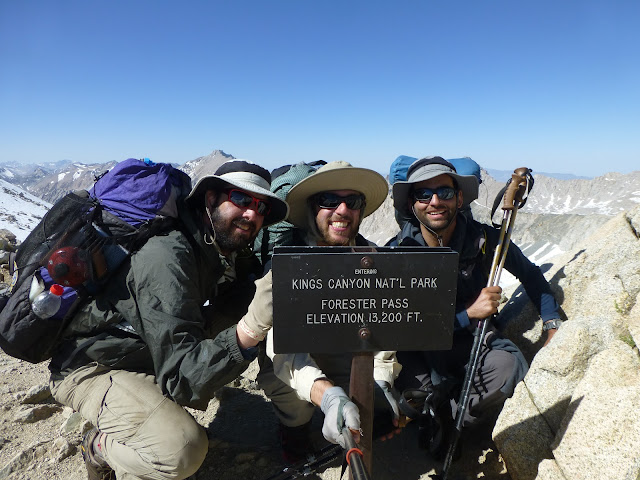
| The highest point on the PCT. It was a tough climb. |
We got to the pass late, at 16:20. But we've made it. The view from the top was amazing, and the North side was
unsurprisingly full of snow. At 13,200 feet, this is the highest point on the pct. High indeed. After a brief photo
session, we started our hike down.
|
| Harmonic Wave climbing back up to retrieve his water bottle. |
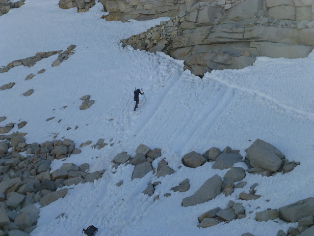
Idan took the lead again, with his micro spikes, navigating us down along the snow trails, from one boulder cropping
to the next, in the general direction of the snow covered trail. The Halfmile gpx file, along with Idan's offline
maps, were very useful.
I don't know which bit was more annoying, the slow hike over snow patches, or the careful one over boulders and
scree. All in wet shoes and feet. We also went twice over snow bridges, while clearly hearing the water rushing
underneath. That was scary.
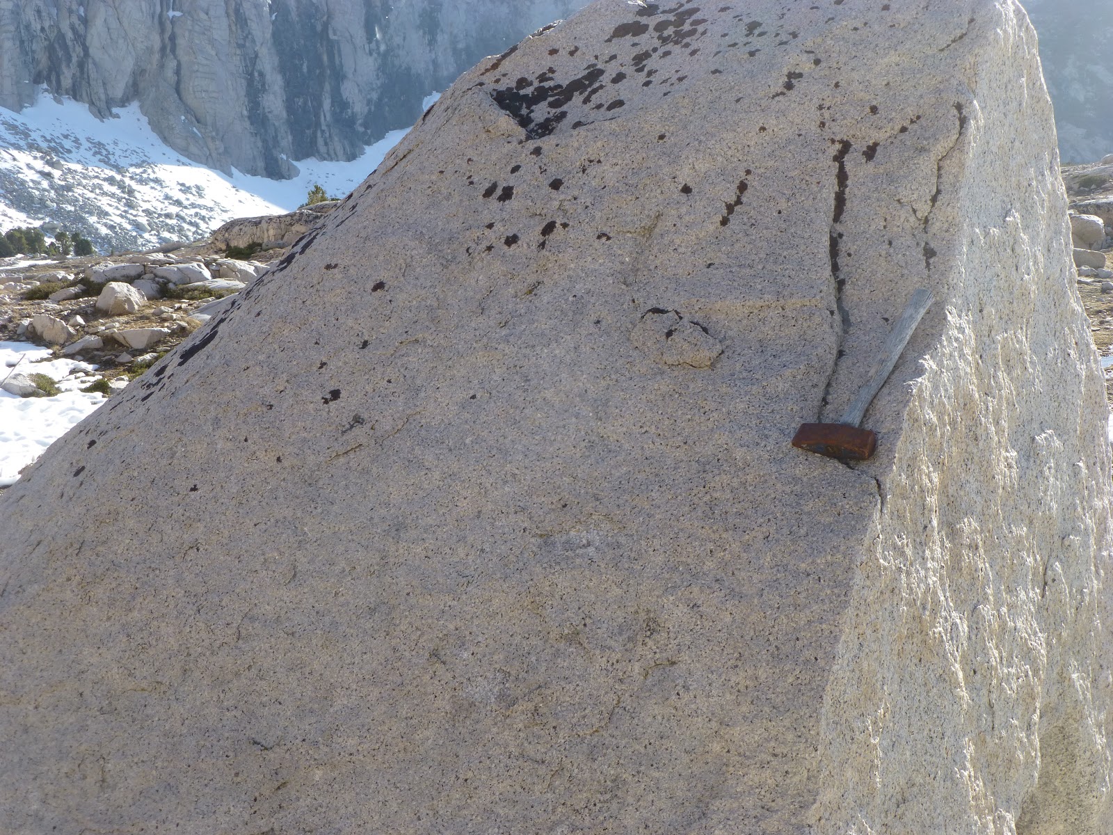
|
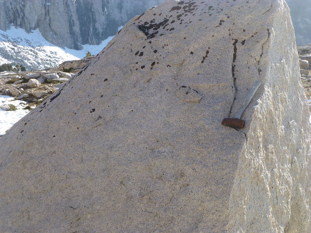
| It seems as though somebody forgot his hammer up here. |
We got a bit lower, and back into tree line. The trail became much easier, and we entered a text book U shaped
glacier valley. We were clearly not in the southern California desert, as water were gushing out of every corner,
and in many cases just pouring over the trail itself.

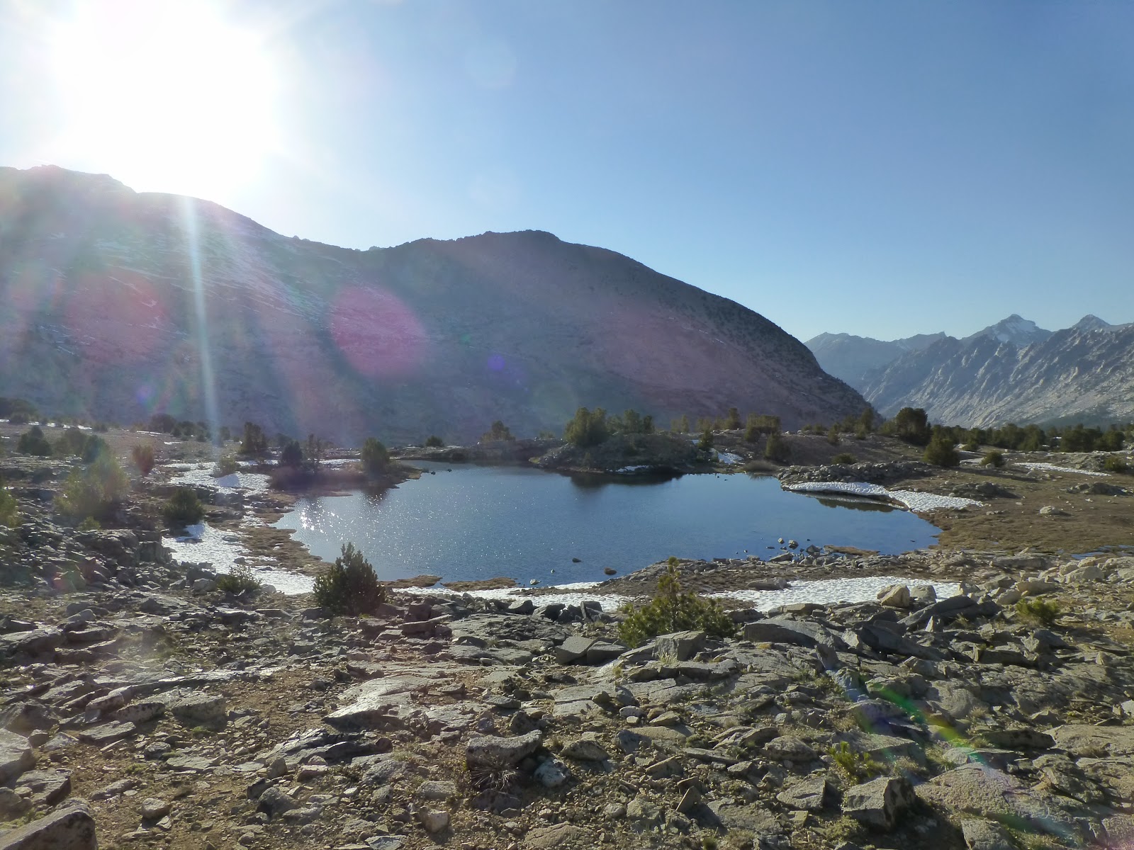
|
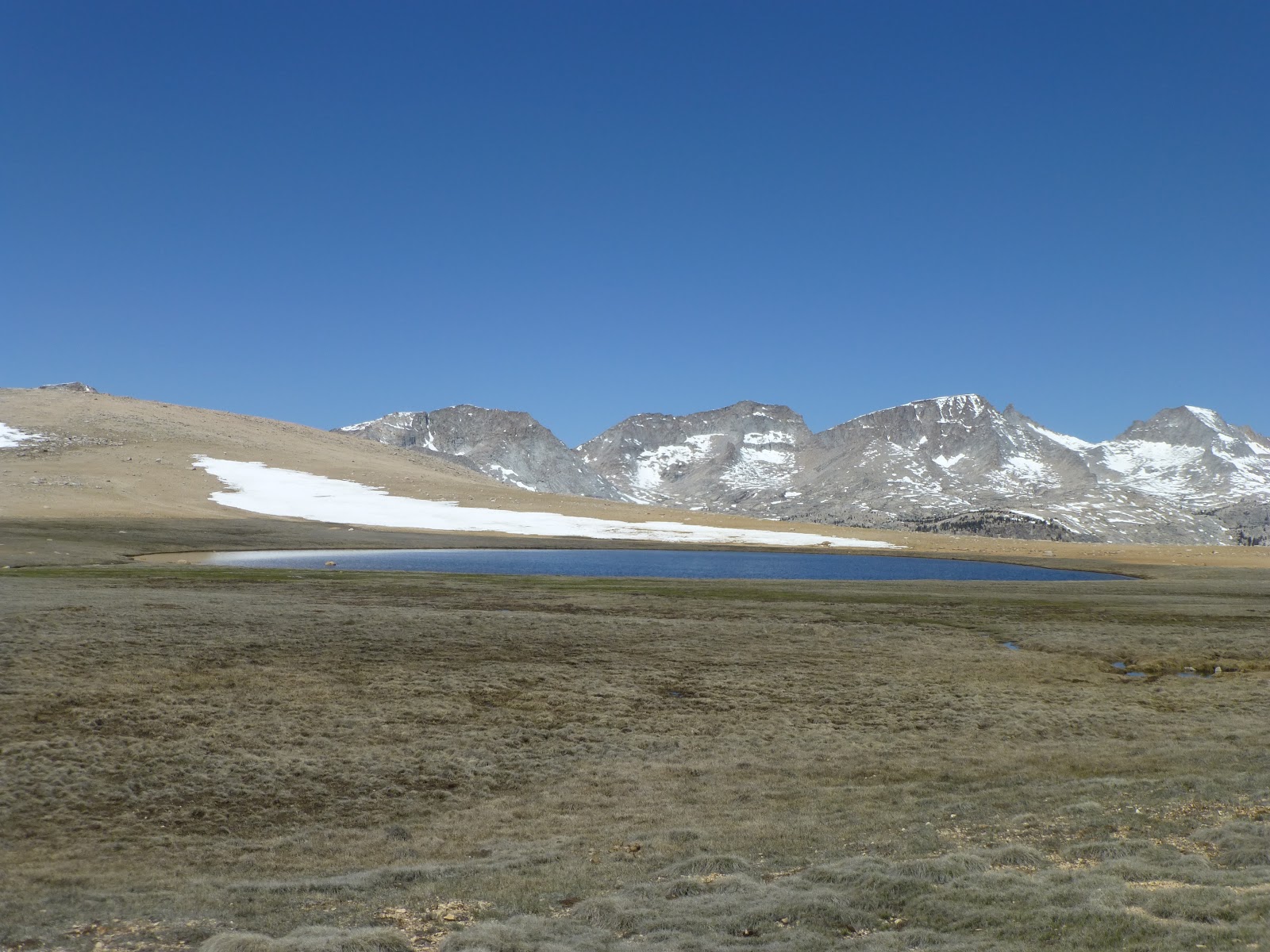
| A nice little alpine pond. |
It took us about 3 hours to get to our campsite, where we met Emu and Mozi, the Australian girls. They also just
came down Forester.
It was our longest day on the trail, and the first time we were eating dinner after dark. I managed to spill half of
my dinner, after pouring in the hot water in the packet, but since it was our last dinner before
resupply, I
just heated more water, and had another serving with my mashed potatoes mix, along with Idan's. So I went to sleep
full.


No comments :
Post a Comment