Wednesday, April 30, 2014

Day 19 - Ziggy and The Bear to 226

Going to sleep last night I kept getting dizzy when I turned around, and I felt hot and cold, like I was having a fever (I checked yesterday morning, and I had none. But maybe I got some later). But during the night it got better, and I think I got a pretty good night's rest.
Another view back to snowy San Jacinto
In the morning I tried to assess how much dizziness I'm feeling, and whether I should head out on the trail. I was worried I'd might have to get to Big Bear by car, just so I can continue with Idan later. But after breakfast I felt almost %100 fine, and decided I'd head out for an easy day.
I finally left at 9:30 (I apologize for not saying goodbye to everyone. I was talking to Ron and we were walking towards the door, and then it felt strange to come back and say goodbye. Sorry.)
Getting some (white) water, and chilling my feet in the steam
The trail was very very windy at first, but as Ron said, it got much more manageable after getting over the first climb. From there the trail kept on the ridge, before going down into Whitewater Creek. A short hike up the creek and I reached the first water source.
I was afraid I will have ask for someone's filter, since mine started acting up on me, and having water spill from the side, when I used it with Smart Water bottles. But I tried it with the original bag, and it worked fine, so I filled up an extra 1 liter with filtered water and set there, trying to decide whether I should keep on hiking through the hot hours (it was around 14:00), or wait for the heat to break, before doing the extra 6 miles of the day.
At the water, I met Smitty and Luna, who set up their tent to stay away from the sun, and Matt, who is hiking the CA section of the trail this year.
The caterpillar of the day
I had a strange encounter with a caterpillar who was probably climbing my hat before I put it back on, and suddenly I felt something crawling on my ear. I threw it away in freight, not knowing what it was, but later during the day I saw a gazillion more and the trail. I think I managed to not step on any. They were kinda cute.
Matt left first, and then I headed out. After a while, when I was climbing up from the creek, I found his camera on the trail. I picked it up, and kept looking up, expecting to see him running down the trail to find it. Just before I reached the top he appeared, and was very happy to see I had it.
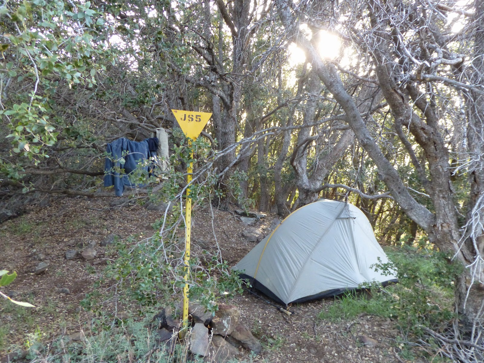
The trail went down and then up another small canyon, climbing up its walls. It was fairly moderate, and then after the third climb it just went up along the ridge, before finally dropping towards the campsite. I really took my time on the last bit, not walking too fast, and I finally got here at 17:20. I filled up my water, and set up my tent next to Matt's, who showed up ten minutes later. Smitty and Luna appeared afterwards, but they just got some water, and headed out to do 3 more miles today. I think I heard someone else just passed by recently, before heading out.
I wonder if hikers that left Ziggy's at the afternoon will get here later, and if they will stay here. I guess I'll know tomorrow morning.
It was a good day, and I'm glad I headed out. Hopefully tomorrow will be as nice.

Tuesday, April 29, 2014

Day 18 - Zero at Ziggy and The Bear

I woke up with a splitting headache and feeling dizzy. A bad start for a bad day.

I was hoping it will get better soon, but the dizziness was here to stay. Finally, Idan left at about 9 to head towards Big Bear. He is planning to do it in 3.5 days, and then take a zero over there. So I'll have time to catch up to him.

The day at Ziggy's was very relaxed, and I might have enjoyed it more, had I not been feeling like shit the whole time. Ziggy, The Bear and Caretaker Ron run an excellent place for hikers to rest.

Many hikers left this morning, and some waited for the heat to break in the afternoon. Some even left at complete darkness. It seems that night hiking is very common on the PCT.

Many new hikers came today, including hiker #400, who got a McDonald's gift card as a bonus. Each hiker that passes through registers and gets his photo taken, and he has to remember his number (mine is 368), so that when he sends Ziggy a postcard from down the trail, they will be able to easily find him in the books.

At 13:00 Ron made the Burger King run, getting everyone's orders. I got their veggie burger and fries. Wasn't too good, but at least I had lunch.

I met Rustic, who hiked the trail last year, and got snowed in just before the Canadian border. His girlfriend (who did the trail on a horse) and him finally finished October 28th. Probably the last of the season. Now he is training to start the trail in June, and finish it in 75 days. Very impressive.

I also met 5 US war veterans who are hiking the Warrior Hike, to "hike off the war". They all came and left today. An interesting bunch.

All in all it was a nice, relaxing zero. But I was too bummed out to notice most of it.

Monday, April 28, 2014

Day 17 - mile 191 to Ziggy and The Bear

That was one cold night up there on the mountain. I had all my clothes on, which meant I had only a pair of boxers and a pair of socks to use as a pillow. It wasn't that bad, except for my feet, which were a bit chilly.
In the morning we waited for the sun to come up over the ridge, and start warming us. Idan had a leak from his water bladder, and he got some of his gear wet, which bummed him a bit. But we took our time, and he got it all dry by the time we left.
The trail was a long waterless stretch for 15 miles of hiking down around 2000 feet. It quickly got down below the snow level, and it was just an annoying downhill slog for a long long while. It was just 4.5 miles as the crow flies, but we had to go the long way around.
It really strange, the way we started in the cold snow, and quickly got down to the hot hot desert floor. We quickly started to miss the chilly weather. I didn't miss the wet feet, though.
We were fantasizing about reaching the spigot and resting there under some shady trees until the heat broke, before we head out to the last miserable 5 miles of hiking along the sandy desert floor. When we finally got there we were sad to discover there is almost no shade in there, but we managed to cram ourselves under a big rock for about an hour of rest.
The Snow Canyon Road faucet, after 16 waterless miles. Oh, and that was all the shade we've had.
We headed out at just before 15:45, and it took us about 2 hours to finally reach Ziggy and The Bear.
This is an awesome place - the house was bought to serve as a pct hostel. They give you an Epsom salt foot bath before you can use the solar shower (by the time I got there it was icy cold), and they accept hiker packages, and also sell many hiker oriented supplies. They also served ice cream. I hot vanilla.
A view back towards snowy San Jacinto from the valley floor
Finally reaching the I-10
There are a lot of hikers staying here at the moment. But we found a good secluded spot to lay our mattresses.

Hikers at Ziggy and The Bear

Sunday, April 27, 2014

Day 16 - Idyllwild to campsite 191

View towards San Jacinto from Tahquitz peak
This was a very long day.

Last night we all crashed at Kay's cabin, by the campground. It was much warmer than sleeping outside, and I slept really well.
In the morning we went back to the campground for breakfast (breakfast burrito with fresh fruit and yogurt), picked up Sunbeam (who insisted she'd rather sleep in her tent), and headed out North back to the trail.
I was trying to decide if I want to walk into Idyllwild from the point where I twisted my foot, or just skip the road walk and continue from Idyllwild. At the end I decided I would hike up from Idyllwild, along the South Ridge trail. I wanted to get back to the trail right at the closure, so that I won't miss any pct miles.
Idan was going to climb out at a different trail, and we planned to meet up at the campsite at pct mile 191.
I started my hike up towards the pct at about 11:00. Quite a late start. The trail up towards Tahquitz peak wasn't too hard, but pretty quick up there it was all snow walk. The trail was very well marked by previous hikers, and it was just switchbacks to the top. The only annoying bit was the snow dumps on my head, as I was passing under those snow covered trees.
I passed several day hikers just before reaching the peak, and the views from the fire tower towards the peak at San Jacinto were very nice.
From there it was a short trail down towards the pct, but I think I still didn't quite make it to the northern closure sign. Oh well.
I hiked north on the pct towards Saddle Junction (where Idan came on it) and I met a ranger who talked to Idan earlier and talked him out of going on the alternate that climbs up the peak of San Jacinto. I was already tired from my earlier peak, so I didn't need much convincing, and I decided I'd also just hike the pct and not the alternate.
I kept on walking, all along in nice weather but in snow. I almost never stopped along my hike, only to munch on Snickers and m&ms.
Snowy trail up on San Jacinto
I was supposed to pass a flowing water source at pct mile 186 (last one for 20 miles) , just a bit after the peak alternate rejoins the trail. I thought I must have already missed it, but I figured I can always melt snow at camp at the evening, if I need more water.
Meeting Idan after a long day alone.
At last, just as I was getting to the water source, I spotted Idan starting to head out. He took a long break over there, and waited for me, and was just giving up. It was fun finding him again, and together we slogged the remaining 5 miles into camp today.
We barely made it during daylight, getting there at 19:40 or so. But we found a nice, snow free spot, just by a picnic table.
I set up my tent, put all my clothes on me, and cooked my dinner from under my quilt. It's cold in here, up at about 2500 meters.

Saturday, April 26, 2014

Days 12-15 - Idyllwild and the Kick Off

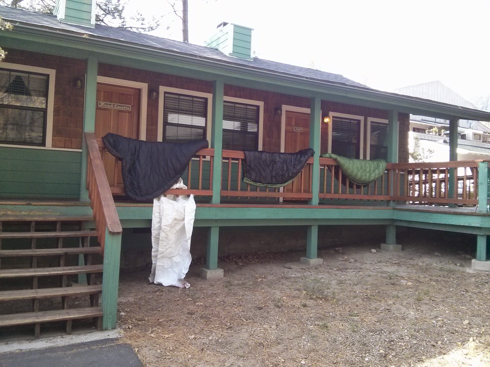
Airing sleeping bags outside, at the Idyllwild Inn
Well, these were some very uneventful days.

On my first day in Idyllwild I went over to a doctor there, and she told me I should just take 600ml of Advil after every meal, and keep my foot iced. She also charged me $65.
For the next two days I spent most of my time sitting in my hotel room, occasionally icing my foot, reading stuff on my phone, and sometimes going out for a pizza or a veggie burger. Idan, on the mean time, watched movies and TV series on his phone.
Idan did manage to get us a ride to the ADZPCTKO (Annual Day Zero Pacific Crest Trail Kick Off) with a very nice lady named Kay, who came over and picked us up at the Inn on Thursday evening. She also picked up Cat Dogs from the Inn, and brought over Sunshine from Ziggy and The Bear (a hostel two days North of us).
We finally got to the Kick Off campground at Lake Morena at around 21:00, and found our campsite and set our tents.
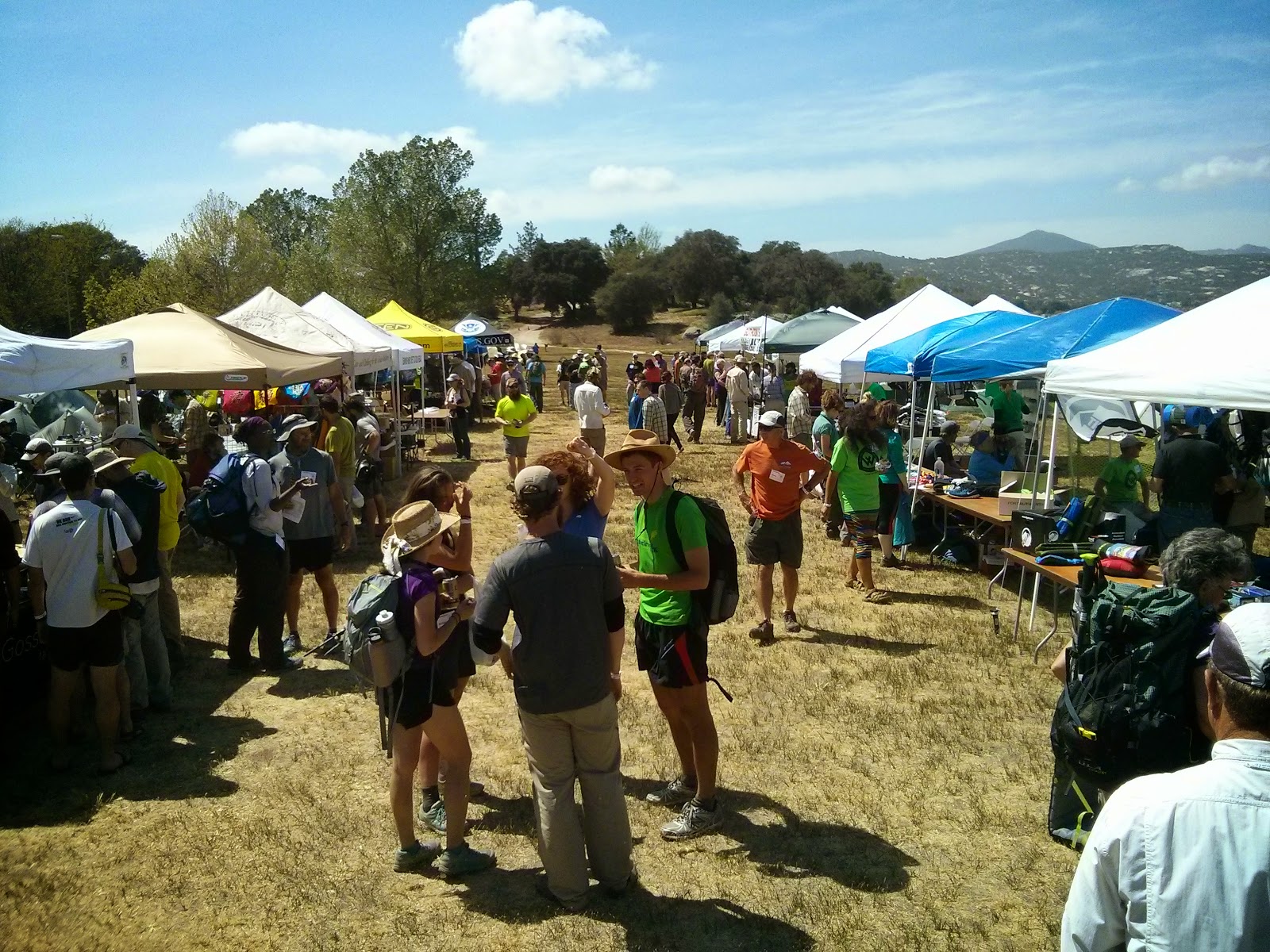
The gear vendors at the Kick Off
We met up with Roi and Sarit (first time I see them since they started their hike), and also finally met Gilad, who just started about a day earlier, and hiked into the KO.
During the two days here we went to some interesting presentations about fire, bears, plants along the trail (not so interesting), and other trail subjects.
There were also a lot of equipment vendors here, selling their stuff to the hundreds of hikers around. I got Henry Shires (founder of TarpTent) to fix a tear in my tent, and send me a pole section to a post office further down the trail, I got Samurai Joe (founder of zPacks) to replace the hip belt pocket of my pack to one with velcro instead of a buckle, and the velcro in my quilt to a buckle, and also the Gossamer Gear crew to send me a new basket for my hiking pole. Overall, a good day (or two).
I also bought a fleece beanie, and StickPic (so I will be able to take selfies with my hiking pole and a timer).
We also spent two hours at the entrance, directing the incoming traffic towards the registration table. At least Yogi brought us cheese toasts and beer.
A hiker (Later named "Sizzler") before his first day on the trail, with his wife
The second night here had terrible weather. Hard rain wind were pounding to tent all night. I remained dry, but my shoes, that remained in the tent's vestibule, got wet. Oh well. Many people got soaked, and many tents were over turned during the night, so I was lucky.
It was drizzling and cold here all day, and we just wanted to get back on the trail, hopefully at some better weather. Gilad decided to head out to Mt Laguna today, so I hope he had an OK hike, with the rain and all. We also met several hikers who just started their trail now, including two Israeli guys, Yonatan and Dor, who didn't prepare much, or check anything on the Internet before coming here. I suspect the carry a lot of excessive gear, but they didn't want to get a gear shakedown from us, or from the professionals at the Wolverines booth. I hope they enjoy their hike.
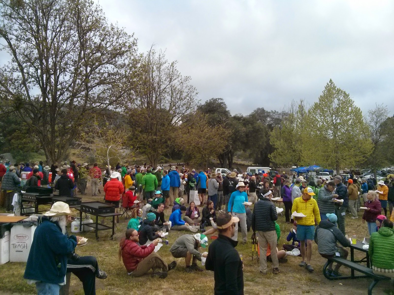
Hikers getting dinner
This night we are crashing inside the cabin that Kay, our ride from and to Idyllwild, has. It's not very big, but we are cramming here along with Roi and Sarit, and Cat Dog, a fellow hiker who came along with us from Idyllwild. It's going to be cozy.

Tuesday, April 22, 2014

Day 11 - campsite 161 to Idyllwild

At least I made it to the closure
Last night I camped high up, right before the trail closure. The spot turned our to be excellent - I had no wind during the night, and it was not too cold at night. Oh, and I didn't make that second dinner, after the veggie burger.
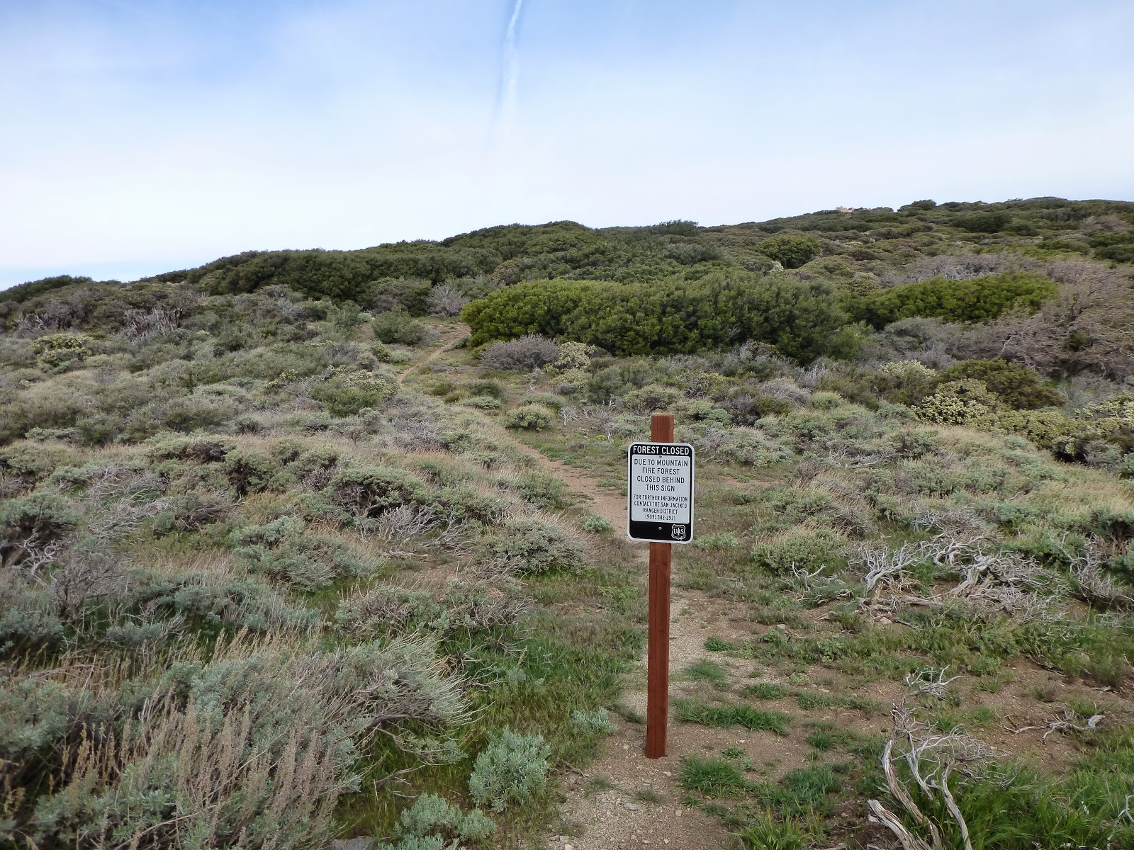
This morning I hiked an easy short trail to the closure sign. It was all up on ridge, and the winds were blowing hard. When I got to the closure I noticed that the eastern side trail, the one heading down to Ceder Spring, is also closed. Just so you know.
I took the western side trail, down from the mountain. I only found out then that the gpx file I had of the detour was for the second day. But I had Halfmile's blog post of that first day with me, including all the twists and turns along the way.
The switch backs down were quite easy. I met a guy hiking up with his dog. Looked like they were just having a stroll. The trail down at the valley was also quite easy, and then I reached the paved road. The road was completely deserted, so be careful, but it's no highway. From there, I found the "Fobes Trail" Halfmile mentioned in his post, and continued down on it, until I could see the highway just about 200 yards away.
I was standing there, thinking that maybe I'll get to the campground early, and just push on to get to Idyllwild this evening, and on the next step I took I really twisted my left foot.
It was quite clear I was not doing any more Mike's today, so I hobbled to the highway, and hitched into town. I got a ride quite quickly (thank you, Candy and Mark), and met up with Idan at the Idyllwild Inn.
Idan plans on hiking up to San Jacinto peak tomorrow, and reach Ziggy & The Bear (a hostel) in two days, to catch a ride to the kick off from there.
I'm showered, got some food (made a salad with a tomato, carrot and an avocado) and am now resting in our room with ice on my foot. I will probably go to a local health center and have someone take a look at it.
I might just zero in here for two days, until the kick off, and then two more zeroes over there. Hopefully that will fix it.
Wish me luck.

Monday, April 21, 2014

Day 10 - campsite at 144 to campsite at 161

It's fun to be at the end of a long, successful, day.
The day started with a hike out to Highway 79, which has a trail famous Cafe 1 mile off trail. Everyone was talking about getting a burger or a breakfast there.
Just about 2 miles after we started our hike, we found the best kind of trail magic - unexpected, and just at the right time. Most people were heading to town from the cafe, but I was going to hike 2.5 more days until I reach Idyllwild, so after drinking a soda, and sending a postcard home (I hope they will send internationally) I also took two breakfasts and one Ramen noodles dinner, and ditched my Outdoor Herbivore breakfasts and one dinner over there. Much better now.
The rest if the morning was uneventful, and after about 2 more hours we got to the cafe, to find all the early starters already sitting there.
Idan is enjoying the Paradise Valley Cafe
The cafe was nice, and I stuffed myself with a full breakfast, and packed out a veggie burger with fries for the evening. I tried asking again if anyone wants to actually hike away, but they were all set on hitching to town, and were already making sleeping arrangements.
At about noon I headed back up towards the pct (add 2 miles to my daily total!) and then I crossed the road and entered the "other side".
A quick explanation: the pct is closed from mile 162.6, up to somewhere on mile 170+. My plan for tomorrow is to reach the closure, and then hike down and off the pct, and to walk on a detour to Idyllwild. Most of it will be on dirt roads paralleling the highway.
So, on I went, to climb 2400 feet (about 700 meters) in 10 miles. The section was completely empty. I only saw some horse tracks along the way. I tried learning from yesterday's mistake, and made a "long", half hour, break at a campsite 4 miles in, only leaving it at 15:00, when the heat was beginning to break.
The views were very nice and mountainy, with many shady spots, and places for rest. I walked rather slowly, and finally got to the campsite up here at about 17:15. A very nice and protected spot, up at 6820 feet (about 2000 meters). I hope it won't get cold tonight, but I can just put all my clothes on, and in my tent, under my quilt, I'm sure it will be all right.
I have finished the burger I was carrying, and am now debating whether I should cook dinner. Currently the vote is "no".


A nice little campsite for the night

Sunday, April 20, 2014

Day 9 - Trail Angel Mike's to campsite at pct mile 144

Pancakes for breakfast!
Last night I learned the hard way that I can't cook the Outdoor Herbivore meal in their bags. All I got was some hard wet pasta, and threw it away. This morning I discovered that their cold breakfasts do work in the bag, but are just not tasty. I'll stick with Knorr meals and Quaker Oatmeal breakfasts from now on. #Fail.
Today was the hardest day yet, mostly because of our inability to take a break at noon, and our head strong approach to reach the campsite as soon as possible. Big mistake. The trail was his usual semi-hard self, but the sun was merciless, and we just kept on hiking, and skipped the side trail to what we now discovered was a spring full of shade.
My first rattler. At least, I think it's a rattler. I am sure it is a snake, though. UPDATE: Just a harmless gopher (Thanks to Mark)
At least we finally saw a big snake just at that junction to the spring. That was a first for me.
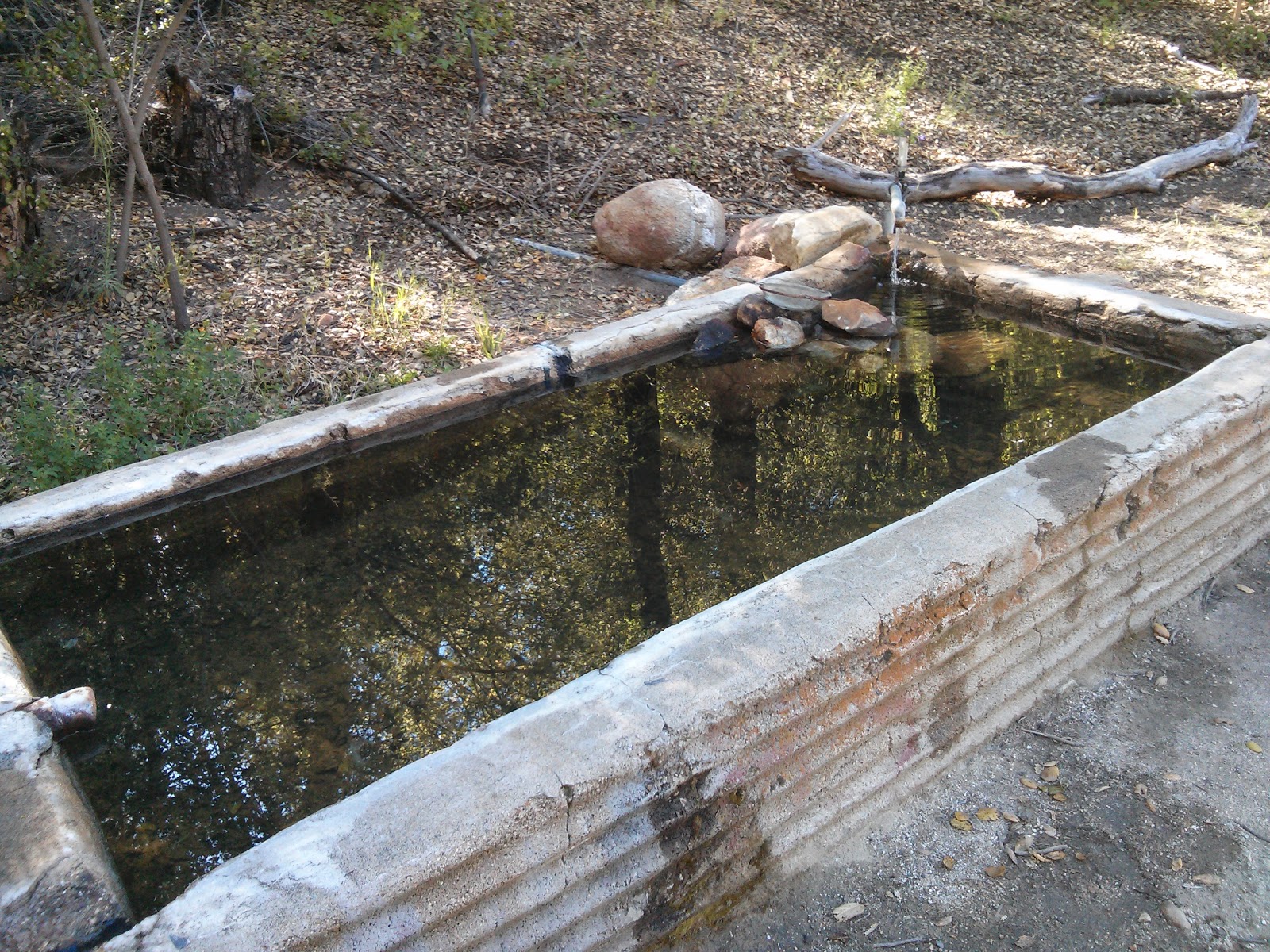
We also had a short stop at the water cistern at pct mile 139.5, but we should have just waited there two more hours. Instead, we headed out for the final stretch. That was the final nail. We were limping towards the water cache, and then from there, the final mile to our campsite. We got here early, but beat. Next time we will plan our day better.
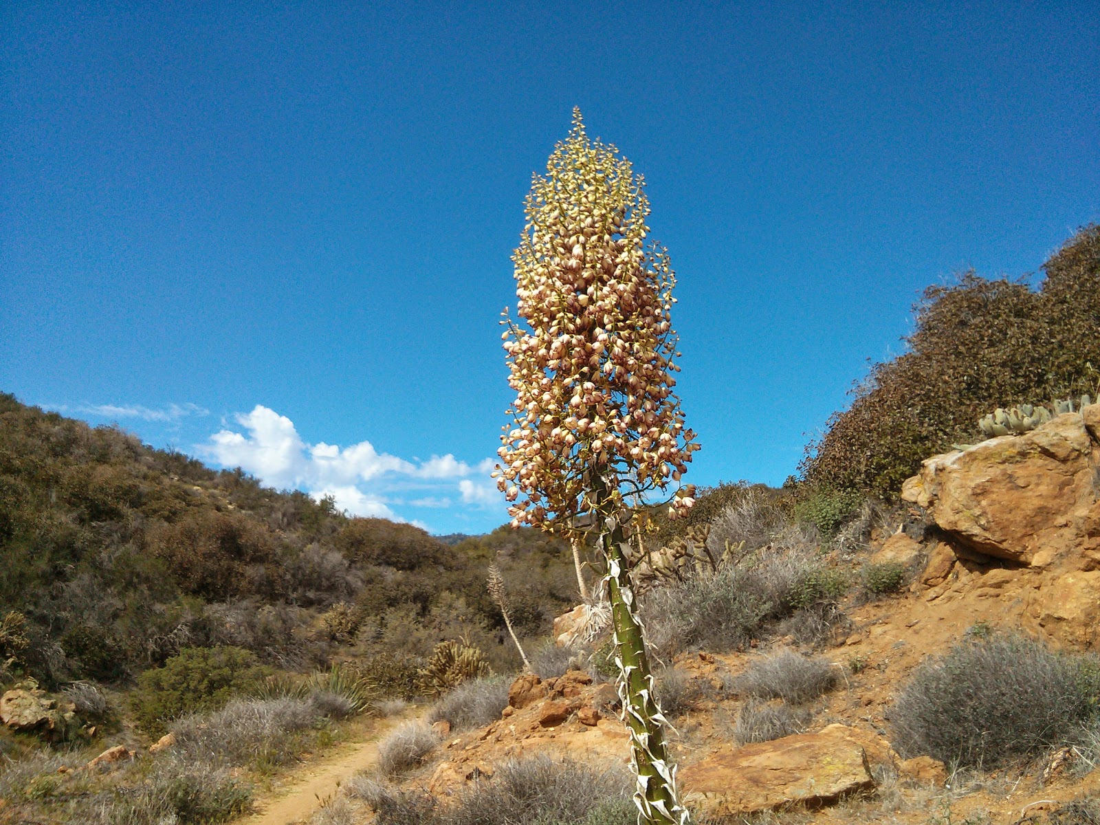
I guess that's some kind of cactus with a nice flower
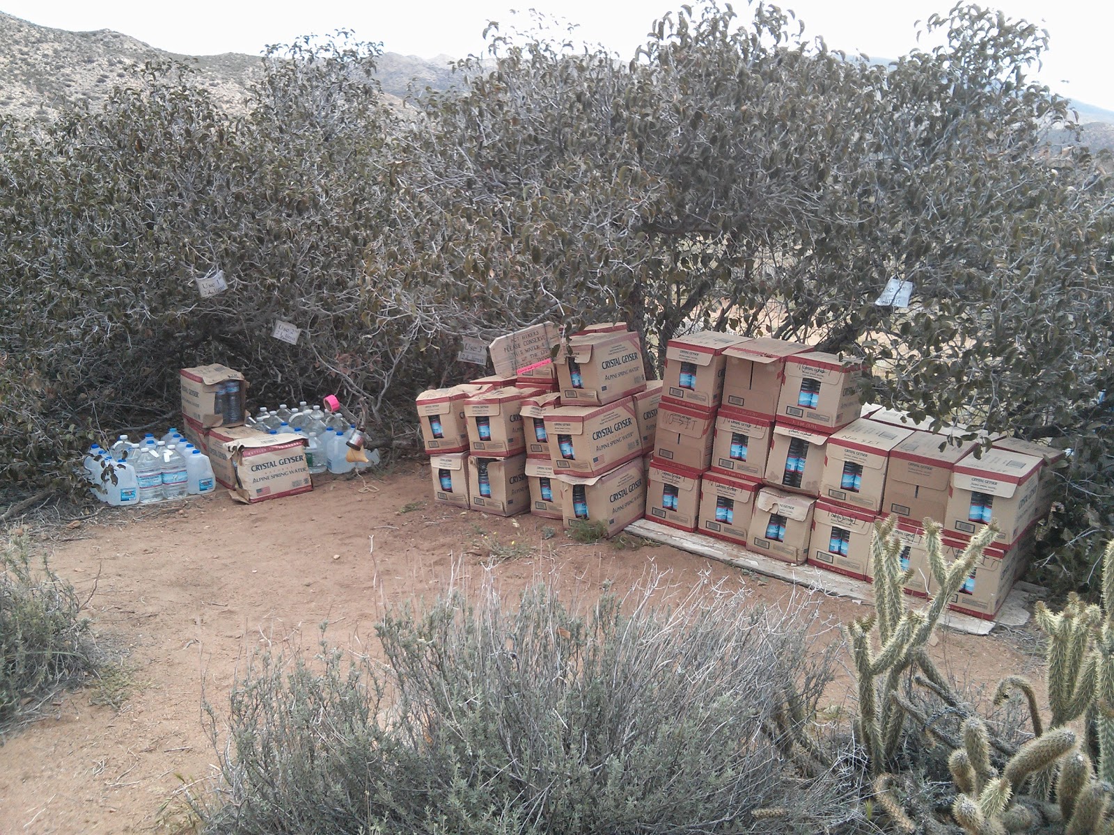
And here is the famous Paradise Water Cache
The campsite itself is rather nice. We got a good tight spot for our tents, and everyone else, who just came in lately, are cowboy camping around. But it is a very nice spot.
Tomorrow everyone will be taking the detour hitch hike into Idyllwild, but I'll continue further on the trail for 10 more miles, to camp just a few miles before the closure. The next day I'll hike down from the mountain, around the closure, and hopefully reach town at the third day. Wish me luck.
Tight campsite for us tonight

Saturday, April 19, 2014

Day 8 - Warner Springs to Trail Angel Mike's

Monty made a huge breakfast for everyone, including omelets with spinach, cheese and tomatoes, hash browns and toasts. It was almost too much.
We got a ride back to the community center, and met all the hikers from last night, who were just getting breakfast themselves. Idan found out he forgot his hat at Monty's, so I hang around until he made another round trip to his house. It wasn't there, and was later found at the community center, having spent the night on the table there.
We finally headed out at 9:20, and started to cross the valley. After the 2nd road crossing we started zip zagging up along the Agua Cliente stream, crossing it several times, and climbing up.
The original plan was to hike 14 miles, to a dry campsite, so we had to fill up our water at some off trail spring. But when we got to its trail head we decided we'd just push to 17 miles and reach Trail Angel Mike' place.
Nice view, right before Trail Angel Mike's
We had some hot sections, mostly while climbing up, it seems. But there were also clouds for a long while, and even two very short drizzles. Nothing to get us wet. So it was fun.
And here is the nice welcome sign
We have finally reached Mikes' at 16:20, and were greated by all the hikers and trail crew who are currently here. It's just a house this Mike dude bought, by the trail, and he doesn't even live here. Kushy is managing the place, taking care of the incoming hikers and making sure everything is in place.
And pizza for dinner. Yum
There are sodas and beers, plenty of room to tent, a small bunk room and an RV to sleep in. Kushy made us pizza for dinner, and we also got leftovers from the trail crew dinner. All in all, a great place to stop.

Friday, April 18, 2014

Day 7 - some campsite to Warner Springs Monty's

We woke up in the morning to the sounds of rain drops on our tents. That was a nice change. It only lasted for a few minutes, and dried out by the time we got outside. But there is rain in the desert!
By the time we left the campsite everyone else were already gone. We had a nice breakfast (especially after last night rice fiasco) and packed up our stuff.
Crossing the 100 mile marker
We had about 6 miles to the next water source (the Barrel Spring), so we cruised towards it, down in the valley. The views on this side of the mountain were different to the other, more deserty side. It had green grass and oak trees. It was a very welcomed change.
The spring site itself was also very nice. We caught up with some hikers there, and had our 2nd breakfast.
From there I continued to run down the trail the remaining 9 miles to Warner Springs. Mid way I also put on some music, and was really enjoying the day.
The trail kept running up and down on some low ridges, all in the valley, before crossing a small stream, and then reaching Eagle Rock (which Idan missed).
Eagle Rock
From there I started passing all the hikers that were ahead of us since the spring. Yay for hiking with music!
We reached the community center at 12:20, met up with Micah (who spent the night at Barrel Spring, and just got the trail named Borealis), told Purple and Carnivore that Roni is saying "hi", and got our burgers.
I also met Little Package (or Puppy) after recognizing her orange van at the parking lot, so that was fun meeting her. She's hiking South towards the kick off tomorrow. Good luck Puppy.
We went over to the post office to get our food drops. In retrospect we could have just resupplied at the community center's small shop. A bit pricey, but it got everything you might need.
I got a "surprise" package from TrailDesigns with the cooking pot I originally ordered. It was only a surprise because I forgot about it. But now I had to get the other one from my pack mailed back to them. The pack was about a mile away...
Borealis with the pie he managed to score from a nearby store.
I got back to the community center and got the package ready, and managed to find some other hiker heading to the post office that agreed to ship it for me. So hopefully that's settled.
We called Warner Springs Monty to ask for a pick up to his house, and he showed up at around 15:30. Most other hikers are staying at the center, even though it seems a storm is coming. It does seem like a nice place to stay.
Right now at Monty's, we are showered and wearing some clean clothes he has laying around. We got here with a couple of Germans that are getting off trail for a while, and there are three other hikers who took a zero in here today.
I just got a blister treatment (I currently have four small ones), and dinner will be served shortly. So it's all good.

Thursday, April 17, 2014

Day 6 - Julian to some campsite

A view back towards Scissors Crossing.
Phew, today was a long day.
We started by having the continental breakfast at the lodge. I just had a danish and a slice of orange.
Then we went out to Mom's Pies, which offer thru hikers a free lunch. It was a bit early for lunch, but they made us the sandwiches and we got the drinks and the pie. We managed without the soup. We got it all to go.
Then was the long ordeal of hitching back to the trail. Took us well over an hour, until a very nice lady picked us up after dropping her son at the school. The live in the small town down by Scissors Crossing (where we had to pick up the trail). She told us that she often picks up hikers, both up to town and back to the trail.
A nice place to sit down and rest.
We finally set foot on the trail at 10:20 - way too late for such a long day. The trail ahead was mostly up and up, sprinkled with a lack of water sources, shade, or anyplace to have a nice rest.
Luckily, the "up" bit wasn't top bad. It was mostly graded, with long stretches of Ridge walking. We also got lucky with some clouds which hid the sun occasionally. With the infrequent wind, it was sometimes even pleasant.
The lack of water wasn't that bad, since we both started with 4 liters of water, so it was enough to get us over to the cache.
The view from the long climb up the mountain×¥
Getting to the cache itself was fun, because I helped restock it just about a week ago. So when I recognized the trail leading to it I felt much better. I was also happy to finally sign the register, since last time around I felt like I shouldn't do it without actually getting there by foot.
Back at the scene of crime, near the 3rd Gate Cache.
During the day we leap frogged many other hikers struggling on their way up the trail. We met Micah at the cache, even though he managed to get a ride 40 minutes before we did, and some other hikers we haven't met lately. Everyone were pushing forward a bit, to make the next day into Warner Springs a bit easier.
We got out of there for some early evening hike. The sun was fully clouded by then, but I felt quite bear at that point. We managed another 3 miles or so, and now we are camped at pct mile 94.4.
Note to self: next time when I buy a dinner, I should make sure it's ready made, and only requires some quick heating. Currently I still have some unmade rice grains stuck in my teeth.

Wednesday, April 16, 2014

Day 5 - Paradise trail campsite to Julian

The trail down towards Scissors Crossing.
Last nice we just met a nice Canadian hiker named Micah, who came in just as we were finished eating and getting ready to crash for the day. We talked about splitting a room in Julian the following day.
We also met a couple of hikers named Purple and Carnivore, and only now I figured out that Roni, a friend of mine and Mega-Hiker (I just write that to do see he reacts to it) knows them as well. So next time I see them I will tell them we have a mutual acquaintance.
In the morning we saw no sign of Micah, so we just packed up and started our hike.
The day was another hot-yet-easy downhill, only this time the views were not as nice as yesterday. After the first 9 miles we reached this water tank where we filled up some extra water, and from there it was just cruising all along the crest down towards the valley, in scorching heat and no shady spots.
Chilling in the shade.
The last few miles were just walking in a straight line on the valley's floor. I just tried to speed through it until I reached Scissors Crossing, which is an intersection of two highways where a trail angel maintains a water cache.
It was a relieve to arrive at the cache, mostly because it's under the highway and it's in complete shade. The fact that there was a cooler with beers also helped.
We've met the hiker who walked all night. And also some others who were pushing on further, and Burning Daylight who is planning to spend the night there.
We went up to the highway to catch a ride, and the second pickup driving by picked us up. We rode at the back the whole way to town, and got to the Julian Lodge.
At first, we got ourselves a double bed room, but as we were getting into the room we bumped into Micah, who said he got a room he planned to split with us, so we cancelled our room, and moved in with him.
After a shower and some laundry, we went over to The Smokehouse, where I got a pizza for dinner, and now I am full and clean, and ready for my beauty sleep.
And a pizza for dinner

Tuesday, April 15, 2014

Day 4 - Mt. Laguna to Sunrise trail campsite

Kids, don't try this at home
All through last night I had to fight with the heating in the room. It was either too hot to breath, or too cold to let my leg out from under the blanket. Either way it was dry as hell.
In the morning we ate the yogurt and apple from yesterday and headed out. The weather was sunny and nice, and the trail was easy and graded.
It was easy to forget we are actually at over 6000 feet (around 2000 meters), because of the nice weather. After a while we started hiking along the rim of a beautiful valley. Way way below us we saw some small hills and a lot of flat fields. It was quite awesome.
The day continued along the rim of the valley, and we made a nice lunch stop at the pioneer trail head (about pct mile 52). We rested our feet, and filled up our water at the nearby trough.
From there, some more ridge walking. This time it was getting a bit too hot, and there was almost no shade. We just kept on walking, only stopping for short rests under some tiny scrubs along the way.
We finally reached the Sunrise trail head (pct mile 59.5) at around 16:00, and headed out towards the campsite with the water that's here.
We met some other hikers staying here overnight - Burning Daylight is out on his second or third thru hike, and his three buddies are escorting his to Warner Springs. Two other hikers have come in and filled up water to continue on their trail. One is planning a night hike tonight. I don't know why.
Later, Purple and Carnivore joined us. They thru hiked the trail before, or at least most of it. And also did the At southbound last year. And finally, Micah from Canada also appeared. We might split a room with him tomorrow in Julian.
Our water source for the night


Monday, April 14, 2014

Day 3 - some random camp site to Mt Laguna

Chilling in front of the Mt. Laguna store
Today we had a nice and easy stroll into town. We only had about 6 miles to go from our camp site, and most of it was fairly easy.
After about 1 mile or so we crossed a small stream, and I finally got an opportunity to use my filter. It wasn't as exciting as I thought it might be. But the water is good.
We made good time, and got into the Mt Laguna lodge at about 11, where we got a room, showered and did some laundry in a bucket.
The outfitter here has everything you'd ever need on the trail, and, apparently, he is also a Facebook friend of mine (hello Dave Super!). He took our photo, and I hope to see it on fb soon.
The store has plenty of hiking supplies, so we got some good for the next two days, until we'll reach Julian.
We were planning on the local restaurant for some burgers for the seder meal, but they only open on weekends, so it's Knorr meal for dinner. I did buy a yogurt and canned fruit salad for dessert, and an apple. So I have something to look forward to.
This is not a Star Observatory. It's just a radar.
Walking the trail around Mt Laguna I saw what I thought was a star observatory, and I was hoping they might have something planned for the lunar eclipse tonight. But sadly, it's just a radar. So I hope I will manage to drag myself outside in time to watch it happen. It will also be freezing outside... So I don't know if it'll happen.
Our first hotel room on trail.

Sunday, April 13, 2014

Day 2 - Lake Morena to some random campsite at pct mile 36.1

The night was a bit chilly, and I remembered why I should have bought a beanie hat. I could feel the heart escaping me from my head while I was sleeping in my tent. Well, I'll buy one tomorrow at Mt Laguna.
In the morning many other hikers went over to the nearby deli to get some breakfast, but we preferred to eat out of our pack instead. It's always better to lighten your load.
We decided we'd rather make an easier day today, and not push all the way to Mt Laguna at 23 miles. We'll get closer, and leave a short section for tomorrow, so we can reach it early on the day, and take our time to do some town chores.
View back towards Lake Morena 
The first 6 miles were rather easy, and we reached Boulder Oaks campground for some nice rest and water refill. I was also surprised to see I have cell reception there, so I called home, which is always nice.
From there we only had ten more miles, but they were not easy. The terrain was all exposed, and we almost couldn't find a shady spot when we needed rest. It was also a lot of ridge walking with many annoying climbs. It was not a fun section.
I tried using my umbrella, by attaching it to my pack. It started fine, but when the wind started it wasn't very comfortable. I will try it again some other day.
We made a short stop at Fred Canyon, which had excellent shade, and then we pushed on for another annoying climb before reaching the camp spot at pct mile 36.1.
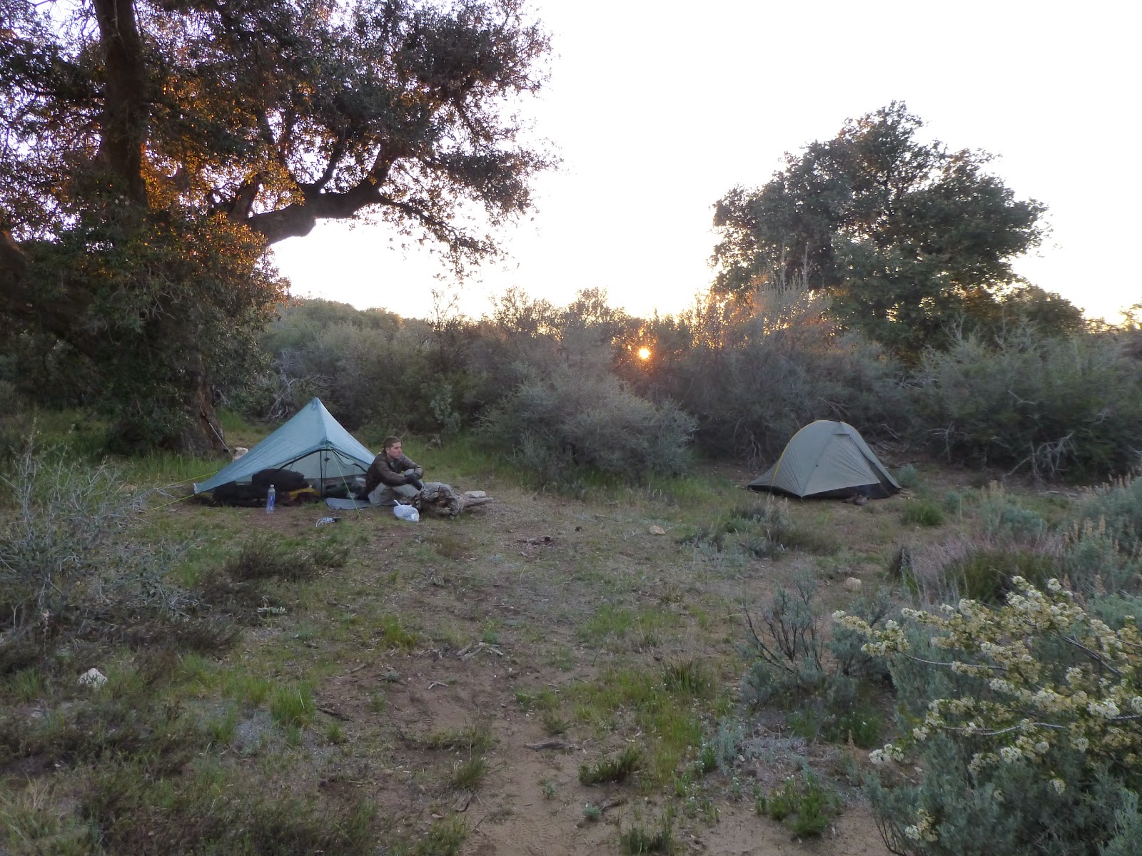
Nothing much here, except for level ground for tents, and a nice oak tree. Not even a water source. But we have enough water for the night, and there's a water source less than a mile away tomorrow, so all is good.
Our campsite for the day

>

Saturday, April 12, 2014

Day 1 - Campo to Lake Morena

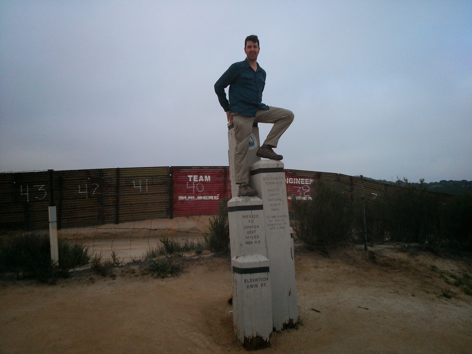
0mi - The Pacific Crest Trail southern terminus
I must admit that the start was a bit of an anti-climax. Maybe it was because I was at Scout and Frodo's for two days, and the initial excitement wore off, or I was expecting too much.
Anyway, we got to the border at around 7:30, took all the mandatory photos (we were 8 hikers starting today from Scout and Frodo's) and then Idan said "let's go", and we went.
The trail was fairly easy most of the day, just cruising around with no major climbs, until we started hiking down towards Hauser Creek (pct mile 15.4). It took a while, and we were happy to rest a bit down under a nice tree.
My initial plan was to stay there for the night, but we got there at 12:50, which was way too early, so Idan persuaded me to keep on hiking to Lake Morena.
The climb out of the creek was a bit annoying, but the worst but was that after it was done, we still had to climb up some more. Go figure.
Getting down to Lake Morena campground also took forever, but we got here at 15:05, so it was good. Met many interesting hikers around here, some of them hiked the AT and the PCT before, and some just started today, like us.
Hikers pay here $5, and are allowed to camp at zones 65 and 66. So you can just stroll in here, set up and leave your stuff, before going to the trail office to pay.

Friday, April 11, 2014

Making Myself Useful

Last night I overheard Frodo mentioning that Jan is going to maintain her water cache, and I offered my help in carrying those water bottles to the cache. I figured I might as well do something useful while I'm here, since I only start my actual hike tomorrow morning.

This morning Jan was glad to accept my offer, and she took me, along with her husband Jim, to the cache. On the way there I heard many stories about the trail, and the trouble the PCTA and local maintenrs have with maintaining it, and making sure everything runs smoothly. It's not an easy task, but all those volunteers are doing it anyway, and we shouldn't take it for granted.

Before we got to 3rd Gate Water Cache (near PCT mile 91), we stopped by the Barrel Spring water & campsite (PCT mile 101), and met up with Lawrence. He was just done cleaning the spring, and replaced all the water in the trough. That's where I first met the actual trail. It was a bit exciting, yeah.

Barrel Spring
From there, we continued along with Lawrence to the 3rd Gate cache, and filled it up with more water. We also carried away the empty bottles and cardboard boxes. It felt nice to take care of the cache, and I can't wait to actually get there on the trail, so I can view the work done there in a different light, now that I know what it takes to maintain a cache (well - I got a small taste of it, at least)
The re-stocked 3rd Gate water cache
Next, we went up the side trail from the cache, back to the PCT. It's a small 5 minute hike. There is a register at the trail junction that Jan wanted to check, and the wooden "Water" sign was mysteriously broken, so Lawrence fixed it with some nails. Everything looks good now.
Climbing up towards the PCT, from 3rd Gate water cache
We went on, southbound on the PCT, for about a mile. One northbound hiker past us along the way. We were looking for an old "water" sign laying in the dirt, near a washed out road which no longer led to any water source. We couldn't find that sign near the junction, but Lawrence and I went down the washed out old jeep road back to the "main" dirt road to meet up with Jan and Jim at their car. It was a nice little hike.

Afterwords we moved on to visit the Warner Spring community center. Even though the site does not have a resort anymore, the community has put together a small store for the hikers, with the stuff that we'd need when passing through. There are also toilets and a shower, and a small restaurant that serves burgers (And - Veggie Burgers! That was really surprising), so we had a nice lunch there, before heading back for the long drive to San Diego.

It's been a long day, but I can't wait for tomorrow, to actually start walking this thing.

Wednesday, April 9, 2014

In San Diego

Well, I'm actually writing this bit from somewhere above the Atlantic Ocean, south of Greenland. But I guess it will be posted once I get to San Diego...

The past few days were strange but nice. I started my leave of absence from work last weekend, so I had five days of staying at home, getting ready for the trail, and having some good time with my gf and cat. It was very nice.

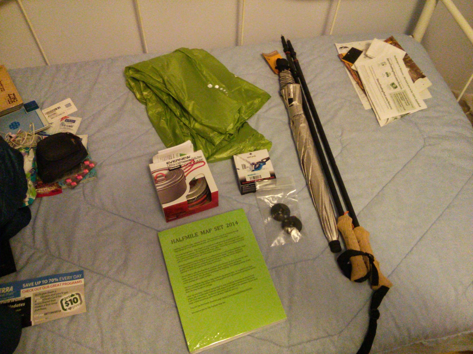
I did some trail related chores, life replacing the battery of my phone, activating my t-mobile sim card (it wasn't easy) and packing about two days in advance.

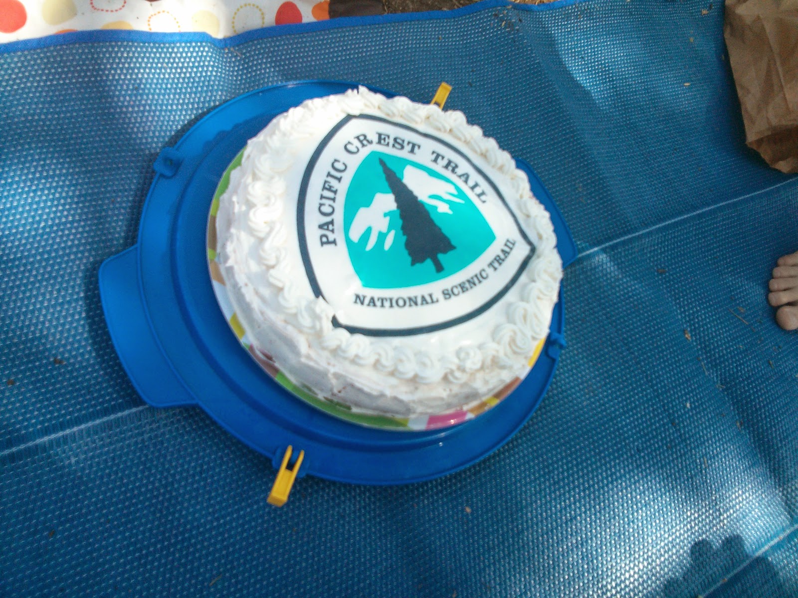
I also had a very nice picnic with my friends, to say goodbye to everyone before I take off. My gf surprised me by getting an edible pct logo and putting it over the cake she made me, which was awesome. And we had some great humus (from Abu-Hassan in Jaffa), so that was really good.
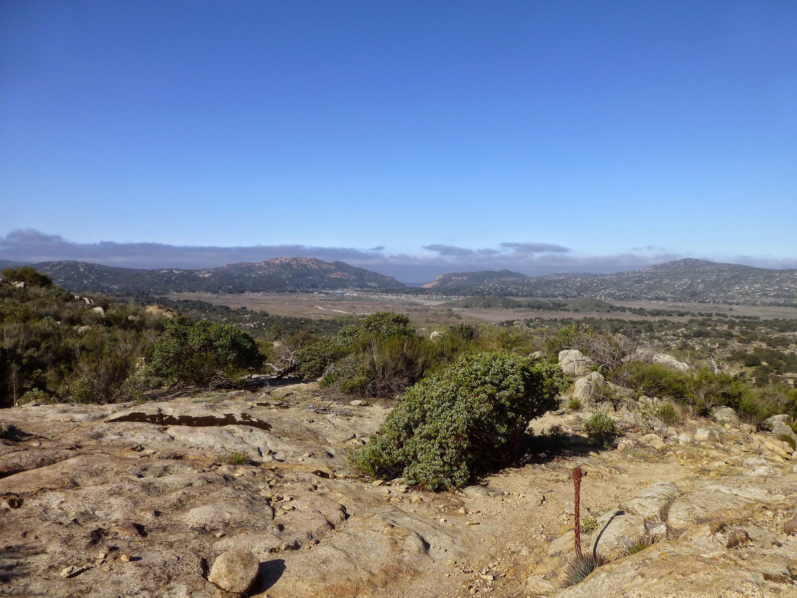
It was also very tasty!
Update
Right now I'm just about off to sleep at Frodo & Scout's house in San Diego. They picked us up from the airport, together with two other hikers, and we met up with Roi and Sarit, who got here yesterday.

Exciting new gear
I got most of the gear I sent here, except the pot I got is 0.6 liters, while I ordered the 0.75 one. Bummer. I'll send it back tomorrow, and probably end up buying a different one at rei.
In two days, probably, I am going to start my hike, together with Idan and Roi and Sarit. Wish us luck.

Saturday, April 5, 2014

Considering my Bump Box

Having no logistical base in the US, I will not be relying on food packages during most of my hike. Since several resupply locations along the trail do not have any actual resupply options in them (No store, basically), I will send myself some packages from other towns, 2-3 weeks before arriving at those locations.
But first, I want to try and arrange my bump box for my hike.

What's a bump box?
A bump box is basically a package a hiker sends to himself, to a town a bit up the trail. Once he reaches that location, he opens the box, gets some needed gear from it, puts in some gear he might not be needing in the near future, and bumps it again to another post office further up the trail. The trick is that if the hiker never opens the package, and it was sent as Express Mail, he can bump it ahead for free (I'm sure there is some fine print regarding this, but that's the general idea).
I expect to open my bump box every time, so I won't be enjoying the tricky bit of the deal, but I do intend to put some stuff in it that I will probably not need in the beginning, and pulling them out as I go along.

So, what will be inside my bump box?
Well, for a start, most of Halfmile's Maps will be there, except for the section I will be currently hiking. At 225 pages, they can get quite heavy for the full set, and completely not needed months in advance.

I will also put in my Marmot Precip rain jacket. I bought a Mountain Hardwear Ghost Whisperer Anorak, which is about 6 times lighter, and should be enough against some drizzling and windy conditions. I hope I won't get a lot of rain at the beginning, but if I do - I'll get wet. I'll pull out the rain jacket (Which served me well on the AT) further up north.

Another piece of gear that I intend to bump ahead, is my Cladera Keg-F Stove System. I really like it, and was sorry to hear I wouldn't be allowed to use it in southern California. I hope I'll get along with my newly purchased Snow Peak LiteMax Titanium Stove, but as soon as I'm able to use my alcohol stove again, I'm switching over. I haven't started walking yet, and I already miss it.

In addition, I will probably put in a mosquito headnet I intend to buy (Probably Outdoor Research Deluxe Spring Ring Headnet, or something similar), a bottle of Dr. Bronner's Castile Liquid Soap (I will carry a smaller bottle with me on the trail).

I will start by sending my bump box from San Diego to Idylwild, for a pick up before my ride to the KO (Or maybe after getting back?). From there, I will probably bump it to Agua Dulce, and to Kennedy Meadows. And then? I'll improvise.

Tuesday, April 1, 2014

The PLB is here

Yesterday I got my Fast Find 220 device, rented from Small-World. It seems like a small-enough device, and I hope I will never need it.


I specifically chose a device with only an emergency option (No daily updates, or checking in along the trail), because I don't want my girlfriend to be worried if I accidentally forget to check in some day, or if it fails somehow. I will call home every chance I've got, and I believe that will be enough to keep everyone back here at ease.

Well, things are moving along. Scary stuff...